


|
||

|

|
|

|
A rare antique map of the Mid-Atlantic, South and Midwest, from Rogers & Johnston's Atlas of the United States, one of the most attractive American atlases of the 19th century. This atlas was an unusual collaboration between an American, Englishman, and Scot. The map is a fragment of Rogers & Johnston's excellent and equally rare wall map. The map names counties, towns, rivers, Indian tribes, and more. The evolution of the Rogers & Johnston work extends to 1873 when a modified example of the wall map was issued in Atlas form, first as the People's Pictorial Atlas by J. David Williams and later as the Jones Historical Atlas, two of the rarer and more interesting late 19th century American works. An important rarity for map collectors of this region.
It portrays a collection of states with close ties that were about to be torn apart by the Civil War. Virginia and West Virginia are still united, four years before they would part ways over the issue of leaving the union. Shows small sections of surrounding states.
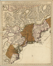
![[ First Map of Maryland ] Nova Terrae Mariae Tabula](https://storage.googleapis.com/raremaps/img/small/98196.jpg)
