|
||

|

|
|

|
Edward Luther Stevenson's Facsimile of the Hereford Mappamundi.
Early photographic reproduction of the Edward Stanford chromolithograph facsimile of the Hereford Mappamundi, perhaps the most famous world map from the British Isles.
The well-known map of the world is an altar-piece in Hereford Cathedral, made by or for Richard of Haldingham. The map is shaped in an oval with Jerusalem in the center.
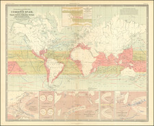
The Stanford chromolithograph of the Hereford map is itself extremely rare and valuable today, with the last copy on the market asking over $20,000.
The Edward Luther Stevenson Collection
Edward Luther Stevenson was among the most important scholars of early cartography active at the end of the 19th century and the first half of the 20th. He was responsible for numerous cartobibliographic books, including the first translation of Ptolemy to English, as well as a series of impressive facsimile maps produced while he was at the Hispanic Society of New York. Dr. Stevenson viewed facsimiles as integral to the study of early cartography, and he committed himself to building an unparalleled collection of photographs of early maps and globes. Much of his collection was donated to Yale University after his death (click on the title link above for about that), but the present item comes from a large collection of photos, manuscripts, and related material that were part of Stevenson's library, but were not donated to Yale. It is truly an impressive collection and many of the items, though reproductions, have serious antiquarian merit. As Alexander O. Vietor said about Stevenson collection that went to Yale "this is the stuff of which great libraries are made."
Edward Stanford (1827-1904) was a prominent British mapmaker and publisher. A native of Holborn in the heart of London, Edward was apprenticed to a printer and stationer at the age of 14. After his first master died, he worked with several others, including Trelawny W. Saunders of Charing Cross. Saunders oversaw young Edward’s early career, ensuring that he became a Fellow of the Royal Geographical Society. Associations with the Society eventually brought Sanders much business and gave him a reputation as a publisher of explorers. As testament to this reputation, the Stanford Range in British Columbia was named for him by John Palliser.
Stanford briefly partnered with Saunders in 1852 before striking out on his own in 1853. He was an agent for the Ordnance Survey, the Admiralty, the Geological Survey, the Trigonometrical Survey of India, and the India Office. He also controlled the maps of the Society for the Diffusion of Useful Knowledge, another lucrative source of income. In 1857, Stanford founded his namesake Geographical Establishment, with Saunders and A. K. Johnston as engravers. Thereafter, Stanford was known for his “library maps”, particularly those of Africa and Asia.
Addresses and Years of Operation:
- 6 Charing Cross, London (1848): Edward Stanford's initial place of employment at Trelawney Saunders' shop.
- 7 and 8 Charing Cross, London (1853): Stanford expanded his shop to these addresses.
- 55 Charing Cross, London (1873): The shop moved to this larger location.
- 12-14 Long Acre, London (1873): Site of the new print works and current flagship store.
- 7 Mercer Walk, London (2019): Stanfords moved to this address, continuing its legacy.
Stanford's work with Chief Cartographer John Bolton, including the 1858 Library Map of Europe, positioned the company as a leader in quality cartography during a time of exploration and colonialism. Their 1862 Library Map of London earned acclaim from the Royal Geographical Society. With the business thriving, Stanford purchased Staunton & Son in 1877 and, upon retiring in 1885, handed over the reins to his son, Edward Stanford II.
As sole agents for Ordnance Survey Maps, the company's influence and reputation grew, culminating in the Stanford’s London Atlas Of Universal Geography, which was presented to Queen Victoria in 1887. The transition into the 20th century saw further integration of retail, print, and cartographic operations at Long Acre.
During World War I, Stanford's became an essential publisher for the War Office. Edward Fraser Stanford took over in 1917, steering the company through the interwar period and innovations, such as the world’s smallest maps in 1922 and the Daily Mail Motor Road Map in 1926.
Withstanding a bombing in WWII, the company continued under the stewardship of John Keith Stanford and was sold to George Philip & Son in 1947. As it adapted to the digital age, Stanfords received the Ordnance Survey Premier Partner status in 2007 and ventured into online mapping and data services.
Stanfords, now an icon for travellers and explorers, has maintained its cultural relevance and retail success well into the 21st century, underpinned by a legacy of entrepreneurial spirit and commitment to cartographic excellence.
![[ World Map ] Карта Шара Земнаго Сочиненная по Астрономическимъ Наблюденїямъ. Жанверомъ. [Globular Map of the Earth Compiled from Astronomical Observations. Janvier]](https://storage.googleapis.com/raremaps/img/small/65900.jpg)