|
||

|

|
|

|
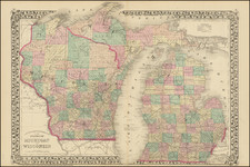
Antique map of Wisconsin and part of Minnesota Territory, produced by Warner Lewis, Surveyor General of the Dubuque Office, on October 21, 1853.
The map shows the plats which had been surveyed and those which were in the process of being surveyed.
The map shows the reservations of the Brothertown, Stockbridge, and Oneida Indians. It also shows the city of St. Paul, Fort Snelling, and the Falls of St. Anthony.
The General Land Office (GLO) refers to the independent agency in the United States that was in charge of public domain lands. Created in 1812, it assumed the responsibilities for public domain lands from the United States Department of the Treasury. The Treasury had overseen the survey of the Northwest Territory, but as more area was added to the United States, a new agency was necessary to survey the new lands.
Eventually, the GLO would be responsible for the surveying, platting, and sale of the majority of the land west of the Mississippi, with the exception of Texas. When the Secretary of the Interior was created in 1849, the GLO was placed under its authority. Until the creation of the Forest Service in 1905, the GLO also managed forest lands that had been removed from public domain. In additional to managing the fees and sales of land, the GLO produced maps and plans of the areas and plots they surveyed. In 1946, the GLO merged with the United States Grazing Service to become the Bureau of Land Management.
![[ St. Paul, Minnesota - Harley Davidson ] Route of the Winter Carnival Grande Parade -- Saturday January 27th. 1940 . . . .](https://storage.googleapis.com/raremaps/img/small/102073.jpg)