|
||

|

|
|

|
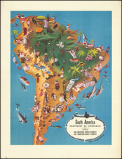
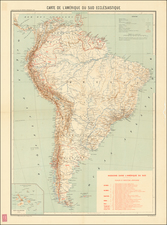
A scarce map of South America which would have been used to educate American schoolchildren about the geography and history of the continent. In order to better help students position the continent globally, latitudes and longitudes have corresponding North American or African equivalents. Details all the major cities of South America, along with their populations. Shows some major peaks with their elevation and rivers with their length. Scattered with drawings which likely indicate the positions of forts and Indian settlements.
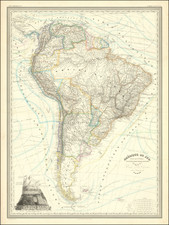
Almost all the geopolitical boundaries of South America are different than their modern-day equivalents. New Granada is in an intermediate stage between the last trappings of Bolivar's dream for a united South America and the present-day nation of Colombia; it still controls present-day Panama. Guinea is subdivided into three provinces, but shown as one nation. Peru has yet to have its boundaries reworked by the War of the Pacific, while Chile and the nation of Buenos Ayres have not colonized Patagonia. The loyalties of Tierra del Fuego are not clearly outlined, but at the time it was not yet part of either country. Some US-centric events are portrayed, notably the capture of the Peacock and the Java during the War of 1812.
![[ First State of the First Map of America ] Novae Insulae XVII Nova Tabula](https://storage.googleapis.com/raremaps/img/small/94609.jpg)