This item has been sold, but you can enter your email address to be notified if another example becomes available.


|
||

|

|
|

|
Stock# 66047
Description
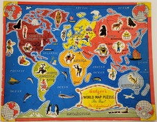
World War II informational map, published by Hammond & Co. focusing on air distances between major points in the Pacific Ocean.
Includes the time zones shown across the bottom.
The map locates the Naval bases of:
- United States
- Japan
- Great Britain
- Netherlands
- Russia
Smaller maps on the vero include:
- The Pacific Ocean
- Commonwealth of the Philippines
- East India Islands
- Hawaii
- Burma, Thailand, French Indo-China and British Malaya
- Japan
- The world.
Condition Description
Folding map.
![[Wall Map of the World] Mappemonde Dressee et Grave Specialement pour Le Petit Journal D’apres les Documents le Plus Regents . . .](https://storage.googleapis.com/raremaps/img/small/70573rd.jpg)
![La Carte Generale du Monde. dressée sur les Relations les plus recentes. Par P: Du Val [General Map of the World, Based on the Most Recent Observations. By P. Du Val]](https://storage.googleapis.com/raremaps/img/small/95625.jpg)