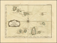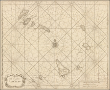


|
||

|

|
|

|
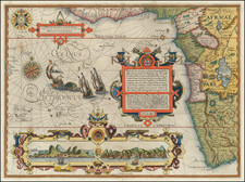
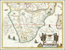
Attractive map of Southern Africa and part of Madagascar, shortly before the first Dutch settlement in the region.
The area shown is from the Congo River basin around the Cape of Good Hope and up the east coast as far as northern present-day Mozambique. Many coastal names shown, including Mozambique Island which was an important stop over for ships sailing to India and points east. To the north, one of the Ptolemaic lakes thought to be the source of the Nile is shown. Information on the interior is sparse, reflecting the lack of knowledge the Europeans had about the interior of Africa.
Mathaus Merian (1593-1650) was the father of engraver Matthäus the Younger, and of the painter, engraver, and naturalist Maria Sibylla Merian. He was born in Basel, Switzerland and trained in engraving in Zurich. After a time in Nancy, Paris and Strasbourg, he settled in Frankfurt. While there, he worked for Johann Theodor de Bry, the publisher and son of the travel writer. In 1617, he married Maria Magdalena de Bry, Johann Theodor’s daughter. In 1623, Merian took over the de Bry publishing house upon the death of his father-in-law. Merian’s best known works are detailed town views which, due to their accuracy and artistry, form a valuable record of European urban life in the first half of the sixteenth century