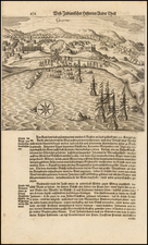


|
||

|

|
|

|
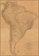
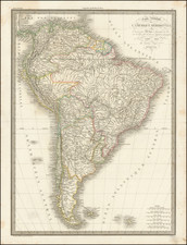
Striking map of the entirety of the South American Continent, toward the conclusion of its revolutionary period, during which time the former Spanish and Portugese colonies systematically ousted the Spanish. The map is unusually detailed. Shows towns, roads, rivers, lakes, mountains, islands, bays, points, etc. Fascinating hachuring style to represent the various mountains and river valleys. A number of territories and intendencies are shown which normally do not appear on the map. Remarkable detail in the interior of the continent. Beginning in the early 19th Century, Lapie was one of the leading French mapmakers, at a time when much of the great exploration and travel literature was being published in French. Lapie was often the engraver of maps which were included in these books. As a result, he often incorporated the most recent information and discoveries in his maps, often appearing prior to the official report from which the information derived. His maps are now prized for their detail, accuracy and attractive engraving style.