
This item has been sold, but you can enter your email address to be notified if another example becomes available.


|
||

|

|
|

|
Stock# 64794
Description
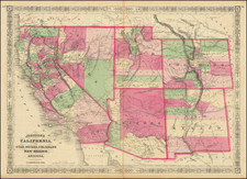
Detailed map of Central America, Mexico and the contiguous parts of California, New Mexico, Texas and the southern United States, published in Weimar.
The map provides a fine early overview of the roads and railroads, including a number of early cross-border links.
Condition Description
Scant later red-ink manuscript just to the left of the title, noting a Pueblo.
![Fly to a Holiday on Continental [Golden Jet Souvenir Flight Map]](https://storage.googleapis.com/raremaps/img/small/90328.jpg)
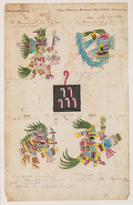
![(Mexican-Aztec Paintings) [Chapultepec and Coyotepec] Mexican Painting. 3738. Codex Vaticanus, page 130, Aglio 2 Vol.](https://storage.googleapis.com/raremaps/img/small/102306.jpg)