


|
||

|

|
|

|
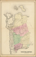
The best 19th-century map of the West Village in Manhattan. The largest map by John Bute Holmes that we have found.
Superb large format, separately issued map of part of the West Village, Meatpacking, and Chelsea in Manhattan, by one of New York's most fascinating mapmakers, John Bute Holmes.
This map is bounded by Fifth Avenue in the east, Amity Street in the south, the Hudson River in the west, and 21st Street in the north.
The map covers the area of several 18th-century estates situated in what is now the West Village, Meatpacking, and south Chelsea neighborhoods of Manhattan. Sir Peter Warren's estate is mentioned; it was comprised of approximately 300 acres of modern-day Greenwich when Sir Peter built his mansion, Warren House, in 1741. Samuel Boyd, whose lands are also shown, was a prominent lawyer and Federalist; along with Alexander Hamilton he founded the New York Evening Post. The Rapelje's were among the earliest Dutch founders of New Netherland; Joris Rapelje arrived in North America in 1624.
In this map, Holmes pays particular attention to the property owners and their land; he gives two long keys -- one A-Z, the other A-U -- to listing their names, many of them now-famous historical New Yorkers.
We locate examples of this map in the New York State Library and UW-Milwaukee.
City Surveyor John Bute Holmes (ca.1820-1887) was a compelling figure, as much for his scandalous personal life, as for his ingenious maps.
The details of his early personal life are difficult to trace, partially as he constantly changed his version of his biography. At one point he claimed to have been born on the Island of Mauritius in 1822, and to have moved from there to Cork, Ireland; according to his account, he moved from Cork to the United States in 1838. He held the position of City Surveyor in New York in the 1860s through 1880s and eventually settled on a farm in New Jersey, where he died.
According to the cataloging of Lindsay Turley, of the Museum of the City of New York:
John Bute Holmes was married to at least four women during his life, sued by a fifth for "impeaching her chastity" as a result of "breach of promise of marriage," known to have lived with another "as husband and wife," and was reputed to have killed a policeman with whose wife he was involved. Some of these relationships appear to have overlapped, and most of the wives were unaware of the previous wives, even when the unions had been dissolved legally. It wasn't until Holmes's death in 1887 that the four legal (or at least to their knowledge) wives came face to face in an attempt to claim their inheritance. The dual nature of Holmes's maps strangely seems to reflect the duplicitous nature of Holmes's life...
A few different accounts in the New York Times attempt to sort it out, and briefly, this is what I've come away with:
- Wife # 1: Anna Maria Clear, married Cork Ireland 1838. Holmes left her in 1856, Anna filed for divorce in 1875. One daughter.
- Living as husband and wife: Ida Kerr, dates unknown.
- Wife #2: Hannah Wright Williamson (also his half-sister), marriage date unknown. Three children.
- Sued for breach of marriage promise: May Chamberlayne, 1874.
- Wife#3: Mary Sullivan Browning, marriage date unknown. One son.
- Wife#4: Katie Meadows, married ca. 1886.
See the MCNY blog entry on John Bute Holmes here: https://blog.mcny.org/2014/03/04/john-bute-holmes-surveyor-and-polygamist/
Holmes is thought to have produced a total of 21 maps of between the 1860s and the 1880s. We have not completed a total census of all map titles from Holmes' series, but we have handled over a dozen from one collection only.
"Farm Maps"
Although it is now hard to believe, Manhattan, as recently as the early 19th century, was largely covered in open farmland. As the city rapidly developed during the 19th century, all hints of its previous bucolic state fell away. In the 1860s, this transformation became a fascination for City Surveyor John Bute Holmes (about whom, more later).
Holmes began gathering old surveys and documents that related to Manhattan's previous land use and landowners, transposing new lot and street detail over the previous geography.
There was a long history of mapping Manhattan's farms, both during the actual agricultural era and thereafter. One of the greatest cartographic feats was Randel's Farm Maps which are reminiscent of Holmes' without the "modern" overlay. http://www.mcny.org/content/randel-farm-maps
![[New York Harbor]](https://storage.googleapis.com/raremaps/img/small/78897.jpg)
![[Assault on Fort Constitution, October 7, 1777]](https://storage.googleapis.com/raremaps/img/small/93152.jpg)
![Supervue Map of New York City [New York's Latest Guide and Detailed Map in Colors]](https://storage.googleapis.com/raremaps/img/small/90455.jpg)