This item has been sold, but you can enter your email address to be notified if another example becomes available.


|
||

|

|
|

|
Stock# 63815
Description
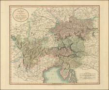
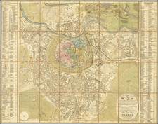
Monumental 16-sheet postal and railroad map of the Austrian Empire, designed by Alexander Mayer, drawn by Johann Gottwald and Joseph Broditzky,
The map includes all of modern day Austria, Hungary, Croatia, Slovenia, Czechia, Slovakia, and large parts of Southern Poland and Western Ukraine, and must of Romania and Serbia.
The most extensive postal and railway map of the monarchy of the time.
Includes several statistical tables and 4 smaller inset maps.
Condition Description
Color lithograph in 16 sheets (18 x 24 each). Laid in original folder with ties and key sheet on the cover. Each sheet laid in loosely with a single fold. Some soilng and fold discoloration. Numbers coming through from back of sheets.
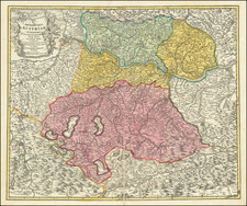
![[ Salzburg, Austria ] Herzogthum Salzburg nach den besten und zuverlässigsten Hülfsmitteln berfasst](https://storage.googleapis.com/raremaps/img/small/103169.jpg)