


|
||

|

|
|

|
Stock# 62632
Description
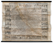
Detailed map of the environs of Paris, published by Le Roi in 1830.
Very rare circular map of the area around Paris, prepared for the use of the travelers.
The map covers and area in a radius of eight leagues, illustrating all the communes, castles and farms around Paris, along with government buildings, the post offices, stage coach roads, etc.
The map is surrounded by 25 vignettes representing the main monuments of Paris and its surroundings.
The plan is accompanied by a chronological table of the main fairs held around Paris and two small maps of the roads and post offices around Paris.
Condition Description
Soiled, with some minor dampstaining.
![[ Paris ] Vue generale des Palais De L'Exposition Universelle De 1878 . . .](https://storage.googleapis.com/raremaps/img/small/74482.jpg)
![[ Paris ] La Ville, Cite, Universite, & Faux-Bourgs de Paris](https://storage.googleapis.com/raremaps/img/small/103453.jpg)
![[ Paris - Place du Roi de Rome - Place de Trocadero ]](https://storage.googleapis.com/raremaps/img/small/90032.jpg)