|
||

|

|
|

|
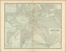
Hubert Jaillot's World Map Re-Issued At the End of the 18th Century
Scarce Dutch decorative double hemisphere map of the World one of the most unique and decorative world maps of the period.
By the end of the 17th Century, Paris was supplanting Amsterdam as a map publishing center and the tradition of highly decorative Dutch engraved maps was being replaced by the more scientific and utilitarian map first produced by Nicolas Sanson in the mid 17th Century. Jaillot's map was one of the last thematically unique world maps, retaining much of the decorative style of earlier Dutch world maps, but trending toward cleaner and simpler imagery in the embellishments.
Eight large and allegorical figures surround the two hemispheres. In the four corners are figures representing the continents: Europe shown as a Queen surrounded by symbols of power and learning; America as an Indian surrounded by a monkey and parrots, with many ships shown off the horizon; Asia holding an incense burner sitting next to a camel, and Africa as a African maid sitting under an umbrella by a pyramid and surrounded by and crocodile, lion and elephant. In the center, two at top and two at the bottom, are four virtues.
Cartographically, the map shows many of the contemporary cartographic myths, including California as an island, a large unknown southern continent and massive Terra Iesso, extending from Northeast coast of Asia to the Northwest Coast of America, separated by a small unnamed strait. The incomplete Australian and New Zealand Coastlines are shown, along with a partial understanding of Tasmania (Van Diemen's Land) and the Northeastern parts of Australia.
First issued by Hubert Jaillot in the 17th Century, the map world endure for nearly 100 years, with Ottens and Elwe issuing later editions of the map.
![[World] Generale Ptholemei](https://storage.googleapis.com/raremaps/img/small/94338.jpg)
![Western Hemisphere [and] Eastern Hemisphere](https://storage.googleapis.com/raremaps/img/small/77454.jpg)