|
||

|

|
|

|
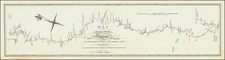
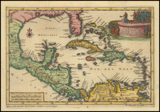
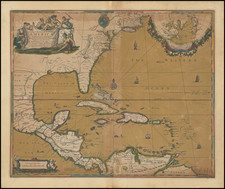
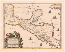
Gorgeous example of Ottens fine map, based upon De Wit. The map provides a large format Portolan style depiction of the region from Long Island and the Cheapeake Bay down along Florida and the Gulf Coast to South America. The map is heavily annotated with sailing directions and routes of the Galleons. A stunning old color example of this highly desireable map.
The Ottens brothers, Reiner and Joshua, operated a successful printing partnership in the mid-eighteenth century (fl. 1726-1765). They began the venture in 1726, publishing maps and other prints as “R & I Ottens.” They specialized in the reprinting of others’ work, especially Guillaume De L’Isle. In 1750, Reiner died; his soon, also Reiner, took his place, but the firm began listing their works as “Joshua & Reiner Ottens.” The firm lasted until Joshua’s death in 1765. Joshua’s widow, Johanna de Lindt, sold their remaining stock of plates in 1784.