|
||

|

|
|

|
Rare 16th Century Italian Map of America
Rare early map of America, published by Arnoldo di Arnoldi in Siena.
Fascinating map of America, drawn from Giovanni Battista Mazza's map of America published in Venice in 1589, but with significant new additions added by Arnoldi. Mazza's map is particularly noteworthy for three reasons:
- First map to show a recognizable portrayal of the Outer Banks of the Carolinas
- First map to correctly name the island of Roanoke, Virginia (founded in 1587)
- First map to specifically mention an English settlement in North America
Arnoldi's map incorporates information from new and different sources, including the Petrus Plancius Wall map of 1592 and other sources:
- Lake Conibaz, drawn from Gastaldi's map of 1561
- A number of rivers west of Lake Conibaz
- Rio Granada extending to "Nuova Granata," with a second river extending to a unnamed lake, featuring the "Sette Citta" (Seven Cities of Gold).
- New Guinea is now shown as an island
Noteworthy Cartography: Virginia, Roanoke, and the Colonization of the East Coast of America
Following Mazza, the map is of note for its cartographic content in Virginia, being one of the first maps to name and locate Roanoke ( Roanoae) Island, with the name Virginia shifted to the mainland. Mazza's map was the first to the name of the island was correctly included and is therefore the first specific reference to an English settlement in North America.
Again following Mazza's map, Arnoldi gives a remarkable early accounting of the Outer Banks. Scholars surmise that that Mazza may have had access to the manuscript maps brought back to England circa 1585 from the Roanoke expeditions.
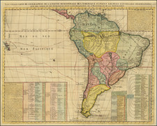
Noteworthy Cartography: South America
The large bump in the west side of South America has been removed, following Hogenberg's map and the revised edition of Ortelius's Americae.
The map is also far more detailed in the interior parts of South America, with significantly more place names and topographical features.
Noteworthy Cartography: the Pacific
The Pacific as shown in this map may appear fantastic to the modern reader, but it would have also been remarkable to viewers in the late sixteenth century.
New Guinea is large, but dwarfed when compared to the huge southern continent that lines the bottom of the map. Magellan's ship Victoria is prominent in the sea off South America, although not nearly as prominent as in Ortelius' Maris Pacifici. Also divergent from Ortelius' Pacific is the ' Stretto di Anian' marked here as running toward the North Pole along what is now known as the Alaska shoreline. Anian derives from Ania, a Chinese province mentioned in Marco Polo's travels. The Strait bearing that name was shorthand for a passage to China, i.e. a Northwest Passage.
The full title map is:
America Il mondo nuovo su chiamato America da Amerigo Vespucci Fiorentino, il quale la scopri circa 5 anni doppo Christoforro Colombo: e da quel tempo in qua e Stata da diversi Scoperta: la qual e inparte ferile, et imparte sterile, secondo la varia natura del suo ciel e terreno: e bagnata molti fiumi, de quali i piu portano l'oro nelle arene. I popoli de la quale hano costumi fieri, et inhumani, sono idolatri; peroche alcuni adorano il sole, e la Luna, e mangino carne humana, e per il piu, vano nudi. Ma doppo la venuto de gli Spanuoli, e predicatione del vangelo, sono fatti piu civili, e particolarmente quei de luoghi marittimi. Ma quei de luoghi mediterranei osservano anchora i lor propry costumi.
Translation: America The new world called America by Amerigo Vespucci from Florence, who discovered it about 5 years after Christoforro Colombo: and from that time onwards and again at different Discovery: which is fertile in part, and partly sterile, according to the various nature of the his sky and earth: many rivers exist, of which the most carry gold in the arenas. The peoples of whom they have proud customs, and inhumani, are idolaters; because some worship the sun, and the Moon, and eat humana meat, and for the most part, they were naked. But after the coming of the Spanuoli, and the preaching of the gospel, they are more civilized, and particularly those of maritime places. But those Mediterranean places still observe their own costumes.
A very similar map was done by Hendrik Van Schoel in Rome (1609), which can be quickly differentiated by the spacing between the "M" and "E" in America, which are joined in by Arnoldi in this map.
Rarity
The map is very rare on the market.
The reported example at auction appeared at Sothebys in 1998. The Antique Map Resources Price Guide notes 2 examples in dealer catalogs, likely the same example (Casten 1988 and Monckton, 1988).
Arnoldo di Arnoldi (d. 1602) was a Flemish cartographer who worked in Northern Italy at the end of the sixteenth century. Arnoldo was in Bologna by 1595, with his brother, Jacobo, where they worked with Antonio Magini. At the turn of the century, Arnoldi moved to Siena and began to work with Matteo Florimi, Magini’s rival. Arnoldi’s transfer may have contributed to the plagiarism case against Florimi by Magini at the same time. However, Arnoldi died only two years later, in 1602. He is best known for his excellently-wrought world map in ten sheets and his set of continental maps, all of which are extremely rare.
![[Unusual Italian Immigrant Communities shown!] America Settentrionale, Centrale e Meridionale -- Carta Dimostrativa Delle Ambasciate, Legazioni, Consolati (Con Le Risettive Circoscrizioni Territoriali), Camere Di Commercio, Agenzie Commerciali, Stazion Enotecniche, Uffici Postali, Ospedali, Scuole Governative e Sussidiate All'Estero](https://storage.googleapis.com/raremaps/img/small/86098.jpg)
![Nov. Orbis sive America Septentrionalis . . [California as an Island]](https://storage.googleapis.com/raremaps/img/small/67439.jpg)