


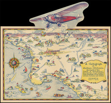
|
||

|

|
|

|
Fine overview of the regions covered by the Wheeler Surveys West of the 100th Meridian, one of the most important government surveys of the Transmississippi West.
The Wheeler Survey comprised multiple expeditions, under the supervision of First Lieutenant (later Captain) George Montague Wheeler. The survey team included Lieutenant (later Brigadier General) Montgomery M. Macomb.
Wheeler led early expeditions from 1869 to 1871 in the west, and in 1872 the US Congress authorized a wide sweeping plan to map that portion of the United States west of the 100th meridian at a scale of 8 miles to the inch. This plan necessitated what became known as the Wheeler Survey. The survey's main goal was to make topographic maps of the southwestern United States.
In addition to the primary survey work, Wheeler was tasked with giving an overview of the geological and physical features of the region; discovering the numbers, habits, and disposition of Indians in the regions; selecting sites for future military installations, locating facilities available for making rail or common roads; and noting mineral resources, climate, geology, vegetation, water sources, and agricultural potential.
The Wheeler Survey lasted until 1879, when the survey, along with the King and Powell Surveys, were terminated and their work was reorganized as the United States Geological Survey.
The maker of the map, Louis Nell would go on to become one of the most important mapmakers and publishers in Colorado in the last 2 decades of the 19th and the early 20th Century.
![[ California & Southwest ] Granata Nova Et California](https://storage.googleapis.com/raremaps/img/small/72305.jpg)
![[San Juan Capistrano to San Onofre] Capistrano Quadrangle](https://storage.googleapis.com/raremaps/img/small/83563.jpg)
