


|
||

|

|
|

|
Searching for a National Road To The Gold Regions of Georgia, North Carolina and Tennessee
Large government published map, illustrating a proposed road from Lake Erie to North Carolina.
This map details the country between Lake Erie south to the Atlantic Ocean near Savannah. The route of the proposed road originates in Portsmouth on the Ohio River and meanders down through Kentucky, [now] West Virginia, Tennessee and to the vicinity of Morgantown in North Carolina.
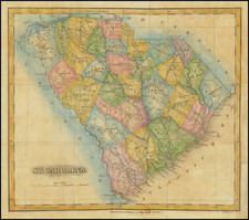
The road was necessitated in part by the discovery of gold in east Tennessee, western North Carolina and north Georgia
The National Road is shown running between Columbus and east to Brownsville, PA. The map locates Louisville, Sparta, Savannah, Charleston, Columbia, Parkersburg, Pittsburgh, Cleveland, and many more towns and cities. Important places like the Charleston Salt Works are also located.
Drawn by Lieut. F.L. Darcy under the direction of Lieut. Col. S.H. Long, Topographical Engineers.
![[Governor of Virginia] The Right Honble William Anne, Keppel, Earl of Albermarle, Viscount Bury, Baron of Ashford, Groom of the Stole, Governour & Captn General of Virginia, Colonel of the Coldstream Regiment of Fort, Lt. General of His Majesty's Forces, Ambassador Extraordinary & Plenipotentiary to the Court of France, one of the Privy Council, & Knight of the Most Noble Order of the Garter &c.](https://storage.googleapis.com/raremaps/img/small/60432.jpg)