The item illustrated and described below is sold, but we
have another example in stock. To view the example which
is currently being offered for sale, click the
"View Details" button below.
1707 Pierre Moullart-Sanson
$ 45,000.00


|
||

|

|
|

|
Stock# 61256
Description
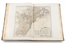
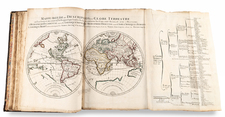
Moullart-Sanson's Very Rare Elementary Atlas with Many Maps of the World, Its Hemispheres, Poles, Etc. in Different Projections.
Quarto (10 x 7.75 inches). Contemporary calf, spine richly gilt (somewhat rubbed and worn, head of spine chipped, rear joint partly split). Engraved title and 25 double-page engraved maps colored in outline.
Pierre Moullart-Sanson, the nephew of Guillaume Sanson, expanded on the work of his uncle.
The maps are dated 1696-1704. The world maps depict California as an island (see McLaughlin 125-126) and Australia.
Though very rare, this work appeared in multiple editions. A fixed set of collations has not been established, but completeness can be assumed, as this copy matches that in the Bibliotheca Angelica, Rome.
Condition Description
Slight browning throughout, minimal staining in places, tear to white margin of 1 map.
Reference
Tooley, Mapmakers IV, page 104 (1710), Pastoureau page 234 (in Mortier's "Atlas nouveau").
![[World Atlas Emphasizing the British Colonies In America] Atlas Minimus Illustratus: Containing Fifty-Two Pocket Maps of the World](https://storage.googleapis.com/raremaps/img/small/94481.jpg)
![The English Pilot. Describing the West-India Navigation, from Hudson's Bay to the River Amazones. [Fourth Book]](https://storage.googleapis.com/raremaps/img/small/71190.jpg)
![[ Ethnographic Thematic Atlas - Poland, Lithuania, Ukraine, etc. ] Völker-Verteilung in West-Russland (Distribution of Peoples in Western-Russia)](https://storage.googleapis.com/raremaps/img/small/94045.jpg)