This item has been sold, but you can enter your email address to be notified if another example becomes available.


|
||

|

|
|

|
Stock# 61011
Description
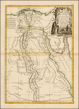
Hand Drawn Antique Map of the Nile from the Cataracts to Alexandria
Detailed map of the Nile River from Alexandria to the Cataracts and the Nubia-Egypt border, illustrating the travels of an English expedition up and down the Nile and from January 12, 1855 to March 21, 1855.
A key at the bottom right identifies:
- Ruins visited on the way up the Nile
- Stops at night on the way up the Nile
- Ruins visited on the trip back down the Nile
The map is signed, but we cannot make out the signature (G. Douglas?).
Condition Description
Divided in 3 sections.
![Barbaria [with] Cartaginis sive potius Tunetani celeberrimi Sinus nec non fortalitij . . . [with] [Untitled map of Egypt]](https://storage.googleapis.com/raremaps/img/small/72788.jpg)
![[Alexandria] Alexandrie](https://storage.googleapis.com/raremaps/img/small/81819.jpg)