


|
||

|

|
|

|
The First Geological Map of Eastern Europe
Rare separately published 4 sheet map of Eastern Europe, which is notable as the first large-format geological map of Eastern Europe and one of the world’s earliest petroleum maps. The map is accompanied by Staszic’s sheet of geological cross-sections of Poland and the High Tatra Mountains.
The map is the work of Polish polymath Stanislaw Staszic and was issued in the same year as William Smith’s Geological Map of England and Wales and Part of Scotland.
The map is also a milestone in Polish cartographic publishing, being one of the first sophisticated scientific maps of Poland and one of the first grand, multi-folio maps to be published in Warsaw. The map was made by the Stanisław Staszic, one of the great intellectuals of the Enlightenment Era. While Staszic and the present map are famous in Poland and revered in international scientific circles, they are largely unknown to the general public and map collectors in the West.
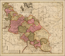
While centered on the Polish-Lithuanian Commonwealth as it existed until 1795, the map covers most of modern Poland, all of Slovakia, Leningrad, Belarus, and Moldova, along with large parts of Ukraine, Lithuania, Romania, Hungary, Serbia and Austria.
The map is accompanied by Staszic’s untitled sheet of geological profiles, or cross-sections; one of which cuts across Poland in general, while the other cuts traverses the High Tatra Mountains. The profile sheet is the first such work relating to the region. Both the 4-sheet map (labelled A-D) and the geological profile (labelled as E) were originally printed within the atlas that accompanied the text volume of Staszic’s O ziemiorodztwie Karpatow i innych gor i rownin Polski [On the Formation of the Carpathians and Other Mountains and Lowlands of Poland] (Warsaw: w Druk. Rządowei [Government Printing Press], 1815). The atlas is a thin folio, consisting of only the present map, present sheet of geological profiles, a panoramic view of the Tatra Mountains and several statistical tables.
While examples of O ziemiorodztwie Karpatow are held by several institutions worldwide, we can trace no examples of Staszic’s geological map, let alone the complete text and atlas pairing, as ever having appeared on the market outside Poland; even within Poland the work is considered a great rarity.
Petroleum
The Staszic map is one of the first petroleum maps, identifying the locations of rock types containing hydrocarbons in a region that subsequently played a central role in the early development of the global oil industry. In the region of Galicia, numerous numbers referencing the locations of various deposits and rocks related to petroleum within the ‘Montagnes Antemarines’ zone. These include: 94. ‘Bitumes’ [Bitumens]; 95. ‘Schistes bitiminieaux’ [Bituminous Schists]; 96. ‘Charbon de terre’ [Soil Carbon]; 97. ‘Blende charbonneuse’ [Carbonic Compounds]; and 98. ‘Concentrations bitimineuses ou bitume durée’ [Bituminous Concentrations or Hard Bitumen]. This data correctly identifies the locations of the natural field occurrences of hydrocarbons such as oil seeps and gas leakages in the Carpathian Mountains.
The part of Galicia identified by Staszic as being home to petroleum-related rock types subsequently became one of the World’s first ‘oil boom’ regions. In 1852, Ignacy Łukasiewicz (1822 – 1882) developed oil ‘mines’ in the region. Importantly, in 1856, he founded the world’s first oil refinery at Jasło, Galicia.
Stanisław Wawrzyniec Staszic was one of the leading lights of the European Enlightenment. He was extraordinary accomplished in many different disciplines, including geology, botany, philosophy, linguistics, literature, economics and religion, in addition the being one of Poland’s great political theorists and statesmen.
Staszic was born in 1755 in Piła, northwest Poland and educated at the Jesuit Academy in Poznań, where he was ordained a Catholic priest in 1774. From 1779 to 1781, Staszic continued his education at the College de France, studying physics and natural history under some of the greatest names of the French Enlightenment, notably including Georges-Louis Leclerc Buffon. Staszic would later translate Buffon’s L’Histoire Naturelle, générale et particulière, avec la description du Cabinet du Roi (1749-89), into Polish.
Returning to Poland in 1781, Staszic was employed as the tutor, and later senior councillor, to the Zamoyski Family, one of Poland’s most powerful and intellectually sophisticated noble clans. He also distinguished himself as the finest French-Polish translator of the era.
In the following years, Staszic became a major figure on the Polish political scene, one of the leaders of a group of young reformers who fought to save Poland from its state of terminal decline. His anonymously published Uwagi nad życiem Jana Zamoyskiego [Remarks upon the Life of Jan Zamoyski] (1787), brought him to light as one of the public intellectuals of Poland.
Staszic’s became one of the principal figures behind the creation of the Constitution of May 3, 1791, a highly enlightened, but ultimately ill-fated, document that called for the reformation of the Polish state in the direction advocated by the Remarks, and was a major backer of the Kościuszko Uprising (1794), a failed attempt to liberate Poland from foreign take-over.
Fearing reprisals from Prussian authorities, Staszic went into exile in Vienna, where he made a considerable fortune in the stock market, which allowed him to finance his subsequent scientific endeavors, including the work that led to the production of the present map.
He devoted much time to exploration of the geology of the Carpathian Mountains, making discoveries that were incorporated into the present map. In 1800, he was one of the founders of the of the Towarzystwo Przyjaciół Nauk, or TPN [Society of Friends of Science], the prestigious scholarly group that would later become the Polish Academy of Sciences.
In 1806, following an expedition to explore the geology of the Tatra Mountains, he created the manuscript for the present map, as well as the draft for the present geological profile of that mountain range.
In 1808, Staszic returned to the political scene, serving on the State Council of the Duchy of Warsaw, the short-lived quasi-independent state supported by Napoleon.
In 1815, Warsaw and much of Central Poland became ‘Congress Poland’, an autonomous region of the Russian Empire. While Staszic was a Polish nationalist, he was also a Pan-Slavist; controversially, he supported the new Russian-backed administration, seeing rule by fellow Slavs as far preferable to Prussian domination. This caused great offense to many Polish patriots, who henceforth saw him as at best a ‘flawed giant’, and at worst, a villain.
Staszic served as the Deputy Minister of Education of Congress Poland, where he initiated many highly regarded reforms to the school system and curricula. He subsequently became the Minister of Industry (1816-24), where he oversaw great advances in fields related to his geological discoveries, namely the mining, metallurgy, light manufacturing and ceramics industries. He was also the first figure to foresee the importance of coal in Poland’s industrial economy. Additionally, Staszic supported farming, founding the Hrubieszowskie Towarzystwo Rolnicze [Hrubieszów Agricultural Society] in 1816.
![[ Earliest Obtainable Map of Russia, Ukraine, and the Caucauses ] Secunda Asiae Tabula](https://storage.googleapis.com/raremaps/img/small/82673.jpg)
![Thietmarsiae, Holsaticae Regionis Partis Typus Auctore Petro Boeckel [with] Prussia Descriptio ante aliquot annos ab Henrico Zellio ab coque D. Ioanni Clur. civi Gedanesi Ded:](https://storage.googleapis.com/raremaps/img/small/45904.jpg)
![[Southern Poland] Polonia Propria, tanquam Regni Polonici Provincia primaria, in Poloniam Maiorem sive inferiorem atque Minorem, sive Superiorem divisa, ut et in suos Palatinatus Sataque Districtus Subsidiis ad normam legitimae Projectionis . . . 1772](https://storage.googleapis.com/raremaps/img/small/77465.jpg)