


|
||

|

|
|

|
Rare separately published map of British Honduras, the future Belize, published by William Faden in 1787.
Faden created what would become the first modern map of what would become Belize on the occasion of the Logwood Treaty (1786), by which the Spanish transferred control of the region to Britain. Faden's map is the first accurate map of modern Northern Belize.
Credited to a “Bay-Man”, the mapmaker's identity is not known, but is most likely a colonist with official responsibilities for land management. Faden's map shows the limits of the newly-confirmed colony, the first such map to delineate the region.
The map covers what is approximately the northern half of modern Belize (from Dangriga northwards), which was then the focus of British interest. While not based upon a scientific survey, the map provides good detail for this previously unmapped region, including the British settlements concentrated on the New River, in the north, including several named properties.
The map illustrates the areas with Logwood and Mahogany stands, along with notes as to their qualities. In this sense, the work is a highly detailed natural resource map.
Until the Treaty, Spain had contested the British presence in the Bay of Honduras. It was only in the period immediately before the present map was issued that British rights in the region were conferred international legitimacy, as agreed by Spain. As shown on map, the areas bathed in a pink wash, running between the Río Hondo, in the north, and the Black Creek and Belize River, in the south, were recognized as being open to British activities by the Treaty of Paris (1783). The tract to the south, located between the Belize River and the Sibun River, shown in yellow, was opened to British development by the Convention of London, popularly known as the ‘Logwood Treaty’ of 1786. The small areas colored in orange indicate locations of British settlement prior to the aforementioned treaties.
The two treaty tracts, would become the colony of ‘His Majesty’s Settlement in the Bay of Honduras’, later British Honduras, and modern Belize. Faen's map would become the authoritative map defining the parameters of the new colony.
As noted by Odile Hoffman, the present work is a “Mapped History” of the British presence in the Bay of Honduras, stubbornly carved out of the Hispano-American world. The map features innumerable British place names, the locations of British logging sites and a note reading “[home to] English Logwood Cutters [for] 30 years”, while some logging areas are noted as having already been “cut out”.
Rarity
The map is extremely rare. We note only 1 other example on the market in the past 20 years.
William Faden (1749-1836) was the most prominent London mapmaker and publisher of the late-eighteenth and early-nineteenth centuries. His father, William Mackfaden, was a printer who dropped the first part of his last name due to the Jacobite rising of 1745.
Apprenticed to an engraver in the Clothworkers' Company, he was made free of the Company in August of 1771. He entered into a partnership with the family of Thomas Jeffreys, a prolific and well-respected mapmaker who had recently died in 1771. This partnership lasted until 1776.
Also in 1776, Faden joined the Society of Civil Engineers, which later changed its name to the Smeatonian Society of Civil Engineers. The Smeatonians operated as an elite, yet practical, dining club and his membership led Faden to several engineering publications, including canal plans and plans of other new engineering projects.
Faden's star rose during the American Revolution, when he produced popular maps and atlases focused on the American colonies and the battles that raged within them. In 1783, just as the war ended, Faden inherited his father's estate, allowing him to fully control his business and expand it; in the same year he gained the title "Geographer in Ordinary to his Majesty."
Faden also commanded a large stock of British county maps, which made him attractive as a partner to the Ordnance Survey; he published the first Ordnance map in 1801, a map of Kent. The Admiralty also admired his work and acquired some of his plates which were re-issued as official naval charts.
Faden was renowned for his ingenuity as well as his business acumen. In 1796 he was awarded a gold medal by the Society of Arts. With his brother-in-law, the astronomer and painter John Russell, he created the first extant lunar globe.
After retiring in 1823 the lucrative business passed to James Wyld, a former apprentice. He died in Shepperton in 1826, leaving a large estate.
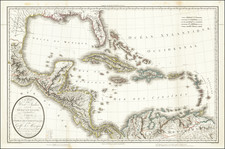
![[Caribbean]](https://storage.googleapis.com/raremaps/img/small/85443.jpg)

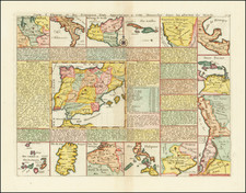
![Amer. Sep. No. 71. Partie Du Mexique et de Guatemala [Oaxaca, Tabasco, Chiapa, Verapaz]](https://storage.googleapis.com/raremaps/img/small/96583.jpg)