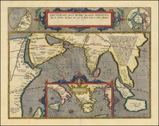
![(Puducherry) Plan De La Ville De Pondicheri Dedie A La Memoire De Mr. Dupleix . . . 1748 . . . [Plan of the City of Pondicherry Dedicated to the Memory of Mr. Dupleix... 1748...] By Depot de la Guerre](https://storage.googleapis.com/raremaps/img/small/95813.jpg)


|
||

|

|
|

|
Striking, Detailed Military Plan of Pondicherry Commemorating the Siege of Pondicherry (1748)
Fine example of the first highly-detailed French military plan of Pondicherry, officially known as Puducherry. It is dedicated to the governor-general of French India, Joseph-François Dupleix, and includes his coat of arms.
The map shows the well-fortified trading post and environs, as it appeared just before the British destroyed much of it in 1761. Outside the town walls are numerous planned gardens and prosperous fields. A swamp is to the northwest of town; it is the marais on this west-oriented plan.
A key at the bottom of the plan explains the main buildings of the town, including the hospital (5), many defensive structures, as well as the seats of government (A) and their offices (D). Several churches are evident (1, 2, 3), as well as a Hindu Temple (11). The latter is a good reminder that Puducherry was a diverse place, with French and Indian peoples. This is also referenced in the dedication, which mentions the black (Indian), Sepoy, and European soldiers involved in the Siege of Pondicherry in 1748.
Puducherry as a strategic colonial trading post
The French East India Company first established Puducherry as a factory or trading center on February 4, 1673, when Bellanger de la Espinary, a French officer, took up residence in the Danish Lodge, which was then a tiny fishing village. In 1674 François Martin, the first Governor, began transforming the town into a major port town and, in time, it became the premier French settlement in India.
The development of the town and its port made it an object of interest to many European overseas empires. The Dutch captured Puducherry in 1693 but returned it to France by the Treaty of Ryswick in 1699. In the eighteenth century, the French expanded their holdings on the Indian coastline, acquiring Mahe in the 1720s, Yanam in 1731, and Karaikal in 1738.
Joseph-François Dupleix, the War of Austrian Succession, and the Siege of Puducherry
Joseph-François Dupleix (1697-1763) is the dedicatee of this map and he played an important role in French India in the eighteenth century. Dupleix was the son of a director of the French East India Company, which allowed Dupleix to visit India and America when he was eighteen. Upon return from this global Grand Tour, in 1720, Dupleix was appointed to the Superior Council of Puducherry, which was the capital of French India. In only 11 years he was promoted governor-general.
After the outbreak of the War of Austrian Succession (1740-48), Dupleix led French troops to seize British assets in India. He captured Chennai, then known as Madras, in 1746. The British also attempted to seize French outposts. In August 1748, British Admiral Edward Boscawen began a siege of Puducherry. However, Dupleix was able to hold out inside the city walls (thanks to Boscawen’s botched siege tactics). The siege was a failure for the British, but it was also the first major action to feature a promising young soldier, Robert Clive. In October, Boscawen’s fleet had to leave due to the coming of the annual monsoon rains.
The siege was the last of the major actions in the Indian theater of the War of Austrian Succession, a conflict also known as the First Carnatic War. This plan was most likely published just after the Treaty of Aix-la-Chappelle in 1748, when France had to return Chennai to the British in exchange for Louisburg in Canada.
Dupleix was recalled to France in 1754. There, he tried to sue the French East India Company for reimbursement of expenses he had made, but he was unsuccessful and died in a state of dubious reputation in 1763.
On January 16, 1761, the British captured Puducherry from the French and destroyed much of it, including the star fort shown on this plan. The rubble and land were returned to France in the Treaty of Paris (1763). The British took control of the area again in 1793 during the Wars of the French Revolution. They again returned the port and town to France in 1814. When the British gained control of the whole of India in the late 1850s, they allowed the French to retain their settlements in the country. Pondicherry, Mahe, Yanam, Karaikal, and Chandernagar remained a part of French India until 1954.
This plan, then, references a high point in the contentious career of Dupleix. It also shows a Puducherry that no longer exists, as the British razed much of the town in 1761. It commemorates a moment of high drama in the history of French Pondicherry, the Siege of 1748, and would benefit any collection of French India or colonial maps and plans.