This item has been sold, but you can enter your email address to be notified if another example becomes available.


|
||

|

|
|

|
Stock# 59280
Description
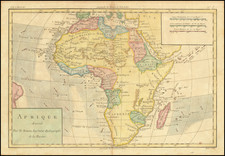
Rare complete set of Poster Maps of Africa, by Raymond F. Elms and published in Chicago by the Beckley-Cardy Company.
These educational maps were accompanied by sheets of symbols, which could be cut out and used by students to match the icons on the map.
The four maps focus on:
- Map No. 1 Peoples, Capitals, Cities, Railroad Centers, Shipping Centers, etc.
- Map No. 2 Physical Features, Animals, Mountains Rivers, Lakes, Forests, etc.
- Map No. 3 Industries
- Map No. 4 Agriculture and Domesticated Animals
The set also includes 9 leaves of cutouts (15 x 23 cm.), 12 leaves of cutouts (31 x 23 cm.), and 1 instructional leaf (28 x 16 cm.) all presented in an envelope (25 x 47 cm.).
Rarity
The set is extremely rare. We locate only the example in the Library of Congress.
Condition Description
Four folding maps in original printed slipcase, with instructions and complete set of game pieces.
![[Spectacular Set of Wall Maps of the Continents Dedicated to King Charles II of England, &c.]](https://storage.googleapis.com/raremaps/img/small/93614.jpg)