|
||

|

|
|

|
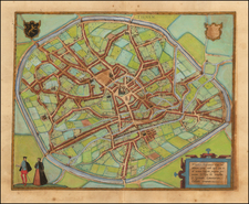
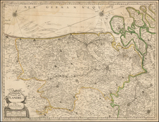
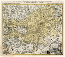
Verbiest's Map of Flanders
Rare map of Flanders, published by Peter Verbiest in Amsterdam.
The map includes City Views of Ghent, Brugge, Dunkirk, Ostend, Sluis, Grevlingen, Ryssel, Douay, Doornick, Aelst, and Hulst.
Along the side panels are costumed images Carte-a-Figures. Lower left corner cartouche with comprehensive title, date and the name of Pieter Verbiest, the publisher. On both sides borders with costumed figures representing the attire of the regional people.
The Verbiest family was a family of mapmakers, printers and publishers. The family fled after the fall of Antwerp to the Netherlands, but returned in 1609 for the duration of the twelve-year truce. The family set up shop in Antwerp at Op de lombaerde vest onder het uithangbord Americ sign, the only map publishing firm to return to the south and publishing.
The patriarch of the family, Pieter Verbiest (ca. 1560-1643) had two sons, among whom Peter II (1607-1669) was the most prolific. It is not always clear which of them was the author of a particular map. Their cartographic production mainly consisted of loose maps.
The firm never published a standard folio atlas, but did produce a small atlas of the Netherlands (1636).
All Verbiest maps tend to be very rare on the market.