This item has been sold, but you can enter your email address to be notified if another example becomes available.


|
||

|

|
|

|
Stock# 58030mp2
Description
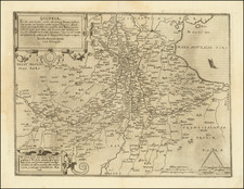
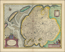
A fine early map of the Friesland, which appeared in Petrus Kaerius's (Peter Van der Keere) Germaniae Inferior id est, XVII Provinciarum ejus novae et exactae Tabulae Geographicae, first published in Amsterdam in 1617.
Van der Keere's atlas was the first separately published atlas of the Low Countries.
Condition Description
Printer's crease at centerfold.