|
||

|

|
|

|
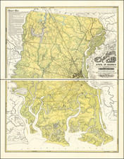
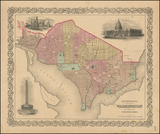
Highly detailed map of a part of Northeastern Virginia and Washington DC. Extends from Washington DC and Fairfax County to Loundoun, Prince William and Fauquier Counties. The map is extremely detailed, showing towns, roads, turnpikes, rivers, lakes, churches, meeting houses, fords, railroads, hospitals, agricultural areas, various surveys and reconnaissances, elevations, and a host of other details. A stand along map of the region, which is the northern sheet of a two sheet map. The pair are offered for $375.00 (#5709--please indicate that you are purchasing the pair via separate email). The map was issued to accompany the monumental Atlas To Accompany The Official Records of the Union and Confederate Armies. 1861-1865. The publication of this work was the most comprehensive compilation of maps of the Civil War.