|
||

|

|
|

|
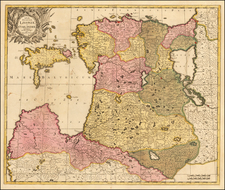
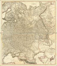
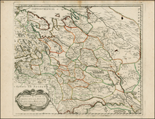
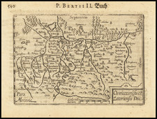
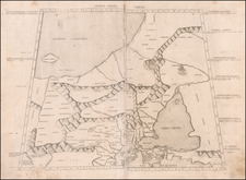
Nice example of Merian edition of this important map of Lithuania at its grandest scale (including Poland, Ukraine and part of Russia), including a large inset of the Dniepr River, based upon Hessel Gerritsz's four sheet map of the same title.
Hessel Gerritsz prepared his original map from manuscript drafts under the instructions of Prince Nicolas Christophe Radziwill. His four sheet map was first issued in 1613 by Willem Blaeu, under Blaeu's original imprint Guilhelmus Janssonis. This is one of the earliest maps published by Blaeu, who did not incorporate this map into an atlas until approximately 1630.
The Radziwill map is one of the most important works of European cartography from the end of the 16th and the beginning of the 17th century and is an important contribution to the progress in the mapping of the whole continent. The map had its beginning in 1586 when Prince Michael Radziwill commissioned M.Strubicz to survey the entire Lithuanian state which then included Poland. Strubicz's map was so accurate and detailed that it provided the basis for all subsequent maps of the area during the 17th and 18th centuries. In addition to the usual topographical details, there is considerable historical information also provided.
Buczek remarks that:
the [Gerritsz] map ... occupies a very prominent position among ... European cartography ... and ... was also a great step forward in the mapping of the lands then forming part of Poland ... there are on the map 1020 towns and villages and within the boundaries of the Grand Dutchy of Lithuania alone there are 511 towns, 31 villages, and 1 monastery.
Following Blaeu's original 4-sheet version of the Gerritsz map, Blaeu and Jansson issued single sheet versions, the latter of which was re-issued by Van Waesberg and Moses Pitt at the end of the 17th century. Merian's edition is drawn from the Blaeu map.
Mathaus Merian (1593-1650) was the father of engraver Matthäus the Younger, and of the painter, engraver, and naturalist Maria Sibylla Merian. He was born in Basel, Switzerland and trained in engraving in Zurich. After a time in Nancy, Paris and Strasbourg, he settled in Frankfurt. While there, he worked for Johann Theodor de Bry, the publisher and son of the travel writer. In 1617, he married Maria Magdalena de Bry, Johann Theodor’s daughter. In 1623, Merian took over the de Bry publishing house upon the death of his father-in-law. Merian’s best known works are detailed town views which, due to their accuracy and artistry, form a valuable record of European urban life in the first half of the sixteenth century