|
||

|

|
|

|
Facsimile of a 15th Century Portolan Chart Attributed By One Scholar To Christopher Columbus
Attributed to Christopher Columbus by a French Scholar, this is a facsimile published on vellum in 1995 by the well regarded publisher M. Moleiro, of the Colombus Mappa Mundi, which includes gboth a detailed map of the Mediterranean, a smaller map and a cosmographic depiction of the earth.
While it is known that Columbus and his brother Bartolomeo were mapmakers, scholars have debated the authorship of this chart since its acquistion by the French National Library in 1848.
For an outstanding discussion of the map, we recommend the following: http://www.myoldmaps.com/late-medieval-maps-1300/257-the-christopher-columbu/257-columbus.pdf
From the publisher's website, which notes a limited edition of 987 copies:
in 1924, Charles de la Roncière, a French historian and cartography expert, attributed to Christopher Columbus a portulan navigation chart which has since been the subject of debate and discussion.
The navigation chart shows the classical design of the Mediterranean area with the addition of the Atlantic coastlines stretching from the south of Scandinavia to the mouth of the river Congo. It features a particularly comprehensive nomenclature of the entire African coast – an area where Columbus is believed to have undertaken at least one voyage with the Portuguese. To the East it encompasses the Black Sea and the Red Sea, and to the West, a series of islands, some real and some imaginary, stretching from the Artic to the Gulf of Guinea.
The elongated part of the parchment shows a small, circular mappa mundi with Jerusalem in the middle surrounded by heavenly rings symbolising the geocentric concept of the universe. Practical navigation charts are not often found alongside cosmographic maps. One of the accompanying notes in Latin says that despite being plotted on a flat surface, the mappa mundi must be thought of as spherical. The portrayal of the earth in this manner confirms the evolution of maps between the Middle Ages and the Renaissance.
The Spanish flag painted over Granada reveals that the map was completed after January 1492, following the conquest of the Muslim city by the Catholic monarchs. Unlike Juan de la Cosa’s planisphere dated 1500 and subsequent maps, no attempt is made in this map to show the new discoveries that were made from 1493 onwards, an indication that it was made in early 1492.
Moleiro notes the following on their website:
M. Moleiro is the most prestigious company in the world specialised in the reproduction of codices, maps and works of art usually made on parchment, vellum, paper, papyrus ... between the 8th and 16th centuries in the form, in most instances, of illuminated books. The techniques employed in reproducing the codices, combined with the wisdom and skilled craftsmanship of our trade, enable us to remain very faithful to the original. Bound in leather tanned used the methods of years past and reproduced on special, hand-made paper, our codices reproduce all the nuances of the paintings, parchment, gold and silver leaf etc. A M. Moleiro codex is, therefore, more than a facsimile book, it is an exact replca, a 'First, unique and unrepeatable edition'.

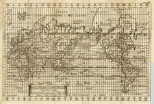
![[ Janet Taylor -- Pioneer English Astronomer and Naval Navigation Expert ] Chart to Accompany R. Russel's Diagram of Great Circles / R. Russel's Diagram of Great Circles](https://storage.googleapis.com/raremaps/img/small/98801.jpg)