|
||

|

|
|

|
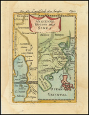
A highly attractive map embracing most of India, made during the height of the Mughal imperial expansion. The map encompasses most of India and Sri Lanka, showing cities, rivers, mountains, islands, political divisions, and more. An intriguing note describes a vast intertidal area at the mouth of the Indus River, supposedly the large tidal flats in the world. An elegant cartouche with elephants and beehive-dwellings completes the composition.
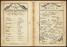
While the various traditional princely states of the subcontinent are distinguished (though some of these kingdoms are more imagined than real) by color, the majority of these had by this time fallen under the rule of the Mughal Empire of Emperor Aurangzeb. During Aurangzeb's reign, the Mughals expanded their presence deep into southern India, although they never managed to conquer the entire subcontinent. Several states, including the Kingdom of Mysore and the burgeoning Maratha Empire, were able to check their advances in the region. At the same time, much of the coastal areas were under the auspices of various European powers, including cities ruled by the English, Dutch, Portuguese, French, and Danes. The numerous forts and trading posts from these colonial powers are detailed on the map.
Pieter van der Aa (1659-1733) was a Dutch mapmaker and publisher who printed pirated editions of foreign bestsellers and illustrated books, but is best known for his voluminous output of maps and atlases. Van der Aa was born to a German stonecutter from Holstein. Interestingly, all three van der Aa sons came to be involved in the printing business. Hildebrand was a copper engraver and Boudewyn was a printer.
![[Ambon Island] Caart van het Eyland Amboina in 't bijsonder](https://storage.googleapis.com/raremaps/img/small/76744.jpg)