|
||

|

|
|

|
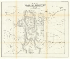
Remarkable large format map of the Ouray Gold Mining District, published 2 years after the arrival of the Denver & Rio Grand Railroad to the town of Ouray in December 1887.
The map includes an early town plan of Ouray, mining claims, rivers, roads, railroad lines, toll roads, buildings, etc. Includes an illustrated vignette of the Beaumont Hotel and approximately 20 advertisements for local and regional businesses. The map is extremely rare. We have located only the example in the Colorado School of Mines and one example in a private Colorado collection.
Ouray was originally established by miners chasing silver and gold in the surrounding mountains. Prospectors arrived in the area in 1875, searching for silver and gold. At the height of the mining boom, Ouray had more than 30 active mines. The town, after changing its name, and also the county it was in several times, was incorporated on October 2, 1876, named after Chief Ouray of the Utes. By 1877 Ouray had grown to over 1,000 in population and was named county seat of the newly formed Ouray County on March 8, 1877. The Denver & Rio Grande Railway arrived in Ouray on December 21, 1887.

![[Austins Colony] Mexico & Guatemala](https://storage.googleapis.com/raremaps/img/small/94054.jpg)
![(Photograph album) America | Hawaii. 1885. [Photographic album of Hawaii, Yellowstone, Utah, Colorado, and Niagara Falls]](https://storage.googleapis.com/raremaps/img/small/87949.jpg)