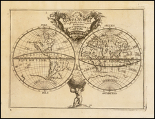
|
||

|

|
|

|
Extremely Rare World Chart by Krusenstern—Leader of Russia’s First Circumnavigation Expedition
Little-known yet striking chart of the world showing the circumnavigation of Ivan Fedorovich [Adam Johann] Krusenstern—the first Russian circumnavigation of the globe. The voyage resulted in a more precise mapping of numerous Pacific locales and was important for natural history and the emerging science of oceanography. This chart was published upon Krusenstern’s return and is much rarer than other publications which derived from the voyage—this example is the earliest known extant copy.
The chart is presented in a Mercator projection, the most useful projection for navigators like Krusenstern. It offers a fascinating glimpse of what was known in 1818. Antarctica is not included; James Cook’s second voyage (1772-1775) had drastically shrunk the possibility of a huge southern continent as had previously been hypothesized. The continent of Antarctica would not be sighted until 1820, when Fabian Gottlieb von Bellingshausen, an alumnus of Krusenstern’s circumnavigation, and Mikhail Lazarev encountered the Fimbul Ice Shelf.
To the north, Greenland’s northern coast remains uncharted, as do portions of far northern Canada. The Northwest Passage voyages that followed Krusenstern’s circumnavigation would fill in several of these gaps. Many islands and geographic features include their date of European encounter, especially in the Pacific Ocean. In addition to Krusenstern’s track, there is also part of Magellan’s voyage around the world, as well as a portion of the Spanish navigator Malaspina’s route.
The first Russian circumnavigation of the world: Krusenstern’s voyage (1803-1806)
Russian officials had avidly followed the news of circumnavigations performed by other nations, including those of George Anson, James Cook, and Louis-Antoine de Bougainville. All of these had also enhanced the geographic and ethnographic knowledge of the Pacific, an ocean which Russia bordered and which it saw as a possible location for imperial expansion. Russia also sought a Northeast Passage for trade with China.
In the late 1740s, Russian fur trading posts were established on the western coast of America, following in the wake of Vitus Bering’s expeditions. By the 1790s, some of these had become permanent settlements. Eager to protect and expand this trade, a circumnavigation was planned in 1787, but it was called off due to wars with the Turks (1787) and the Swedes (1788).
Over a decade later, Russia had become a major naval power and their sights turned again to the east and the Pacific. The newly-created Russian-American Company and Emperor Alexander I approved the plan for a circumnavigation and appointed as its leader then Captain-Lieutenant Krusenstern, who had returned to Russia in 1799 after six years with the British Royal Navy. While with the British, Krusenstern had visited North America, South Africa, the East Indies, and China. This experience, and his three written proposals suggesting a Russian circumnavigation, qualified him for the appointment.
The voyage was to ferry a diplomatic contingent to Japan in search of favored trading status. In this vein, Count Nikolai Petrovich Rezanov was appointed co-commander along with Krusenstern; he was also to be Russia’s ambassador to Japan. The ships were also to ferry supplies to and receive cargo from the settlers on the North American coast. The Nadezhda and Neva, renamed English ships purchased especially for the circumnavigation, departed Kronstadt on August 7, 1803 with Krusenstern in command of the former and Yuri Lisyansky in the latter.
The ships headed west to Copenhagen, Helsingor, and Falmouth, then entered the open Atlantic. They stopped at Tenerife and then Brazil before rounding Cape Horn. In the dangerous waters of the Cape, the two ships were parted. The Neva waited for Krusenstern at Easter Island, but the Nadezhda had already sailed to the Marquesas. Lisyansky joined Krusenstern there in May of 1804. They sailed together to Hawaii and then on to the Russian settlements in what is today Alaska.
In Alaska, Lisyansky came to the aid of Russian settlers at Sitka, who were besieged by Tlingit Indians. Krusenstern picked up a cargo of goods and delivered them to Kamchatka before continuing to Japan. He anchored in Nagasaki harbor for six months while negotiators tried to gain approval for a Russian Embassy on Japanese soil. The negotiations failed and the Nadezhda returned north to Kamchatka, where Rezanov departed to serve as Imperial Inspector and plenipotentiary of the Russian-American Company in North America. Then, Krusenstern explored the coast of Sakhalin, trying to discern whether or not it was an island.
The ships reunited in Macao, where they spent three months selling furs and taking on tea. From China, the ships crossed the Indian Ocean, rounded the Cape of Good Hope, and entered the Atlantic. Lisyansky sailed straight home, but Krusenstern stopped at St. Helena briefly. He sailed back into Kronstadt on August 19, 1806.
Legacy of the voyage
Not only was this the first Russian circumnavigation, it was also one of the first scientific voyages commissioned by the empire. The naturalists gathered many new and rare specimens, while the navigators made important advancements in oceanography. For example, Lisyansky proved the existence of equatorial counterflow in the Atlantic Ocean. Ethnographic descriptions, particularly those from the Marquesas, were pivotal for the study of Pacific peoples. Two men who served on the expedition, Otto Kotzebue Bellingshausen, would later lead their own voyages: Kotzebue a circumnavigation and Bellingshausen, with Lazarev, the first successful Antarctic exploration.
Krusenstern and his men were excellent sailors who surveyed many places with more accuracy than previous attempts; these included Easter Island, the Marquesas, Sakhalin, Hokkaido, the Tsushima Islands, the west coast of Japan, and other locations. They also discovered passages through the Kuril Islands. Krusenstern relied on maps from fifteen different authors in various languages while at sea. His own maps are renowned for their accuracy and his latitude calculations deviate from modern data by no more than two angular minutes and in longitude by no more than four minutes—a monumental feat.
Publication of this chart
Upon his return to Europe, Krusenstern threw himself into revising his papers and preparing an account of the voyage. He was not alone, Lisyansky and other members of the voyage would also eventually publish their version of events. Krusenstern, however, was the most prolific.
In 1809 he published a three-volume account of the voyage in Russian, while a German version appeared in 1810 in three volumes with an accompanying atlas. Reise um die Welt, in den jahren 1803, 1804, 1805, und 1806 proved popular and was quickly reprinted in Leipzig and Berlin and translated into Dutch, Swedish, Italian, French, and Danish. In 1813, the English translation was published by John Murray, who specialized in the publication of travel and exploration books.
In England, the book struck a chord with a reading public that was then obsessed with the Northwest (or Northeast) Passage and the Arctic. Krusenstern was required reading for the Polar explorers that would venture north in the 1820s, including John Ross, William Edward Parry, and John Franklin. In fact, John Ross would edit a memorial to Krusenstern in 1856, translated from German and written by Krusenstern’s daughter. This was not the only English tie that Krusenstern’s voyage had, however, as the London publishing of this chart shows.
Krusenstern himself was in London in 1814 and 1815, inspecting the instruments of Edward Troughton, renowned instrument maker whose shop was on Fleet Street. At the time, the best instruments in the world were made in London and Troughton, who also supplied instruments to the Royal Society, was considered the most skilled instrument maker in Europe. As Krusenstern was already in London acquiring new instruments for the Russian Imperial Navy, he had this chart engraved while there as it was convenient and prescient.
The map was engraved and signed by J. Walker of London. This most likely refers to John Walker (fl. 1783-1831). Walker was known for his chart engraving and worked privately for Alexander Dalrymple from 1783 and for the Admiralty after Dalrymple assumed his position as the first head of the Hydrographic Office in 1795. Walker continued to work for the Admiralty under Dalrymple’s successor, Thomas Hurd, and it is through the Admiralty that Krusenstern most likely learned of the engraver. Walker, and his son of the same name (fl. 1813-1873), were founder members of the Royal Geographical Society in 1830. It is possible (but less likely) that his son was the engraver of this chart, as he also engraved for the Admiralty.
The chart was initially issued in 1815 and was meant to complement, but not necessarily to be bound with, his voyage account and atlas. This is a corrected example from 1818. There are also later corrected examples known, dated 1817, 1822, and 1825. All are very rare. In 1819, a memoir of the chart was published in Leipzig entitled, Beyträge zur Hydrographique der Grossen Ozeane als Erläuterungen zu einer Charte des ganzen Erdkreises nach Mercator’s Projection.
In the introduction to the book, Krusenstern reveals that the chart was intended to be the general chart to accompany an atlas of his travels, but the Napoleonic Wars cut him off from the necessary charts from England and he could not produce the chart to the highest degree of precision that he desired. He also explains that the initial chart was drawn by then fourth lieutenant Bellingshausen and improved with sources he picked up in England on his trip in 1815. He had the chart engraved in London, but he could not complete the corrections before he left for the Continent. He continued to revise the chart—the Leipzig memoir was supposed to accompany an 1817 state—and this 1818 example shows his continuing revisions.
Rarity
The chart is the rarest of Krusenstern’s hydrographic outputs and this example is the earliest extant known to survive. There are no records of its being sold in the past thirty years. We note copies of the 1819 and 1822 map in the online catalog of the National Archives of Estonia and the Tallinn City Archives and an 1825 copy at the British Library. OCLC lists up to seven other institutional examples.
It is the only of Krusenstern’s charts to have been published by him in London. It is a vitally important chart underlining Russia’s entrance onto the global stage of exploration and would be a pivotal part of any collection of Russian or exploration cartography.
Sir John Ross (ed.), Memoir of the Celebrated Admiral Adam John de Krusenstern the First Russian Circumnavigator Translated from the German by his Daughter Madame Charlotte Berharndi (London: Longmans, Green, Brown, and Longman, Paternoster Row, 1856).
Laurence Worms and Ashley Baynton-Williams, British Map Engravers (London: Rare Book Society, 2011).
Ivan Fedorovich Krusenshtern, also known as Adam Johann von Krusenstern (1770-1846) was a Russian naval officer and hydrographer. He led Russia’s first circumnavigation and published numerous charts, particularly of the Pacific Ocean region.
Krusenstern was born in Hagudi, then part of the Russian Empire but now in Estonia. At the age of seventeen he joined the Russian Imperial Navy and first saw action in a conflict with Sweden. He was seconded to the British Royal Navy during the Napoleonic Wars. Between 1793 and 1799 he served in British vessels and traveled to North America, China, South Africa, and beyond. He then returned to Russian service and lobbied the Imperial Navy to support a voyage of exploration that would also serve as Russia’s first circumnavigation.
Under the patronage of Alexander, Count Nikolay Petrovich Rumyantsev and the Russian-American Company, Krusenstern led the first Russian circumnavigation of the world from 1803 to 1806. This mission was aimed at enhancing the fur trade with Russian America, notably Alaska, and sought to establish trade relations with China and Japan, explore trade possibilities in South America, and survey the coast of California for potential Russian settlement.
The expedition consisted of two ships: the Nadezhda (formerly the British Leander), commanded by Krusenstern, and the Neva (previously the British Thames), under Captain-Lieutenant Yuri F. Lisianski. Departing from Kronstadt in August 1803, the voyage spanned the globe, passing Cape Horn, exploring the northern Pacific, and returning via the Cape of Good Hope, with Krusenstern arriving back in Kronstadt in August 1806. The expedition made important contributions to oceanography and hydrography in the Marquesas, Japan, Sakhalin, and the Northwest Coast of North America. Upon his return, Krusenstern was celebrated as a pioneer of Russian science and was awarded an honorary membership in the Russian Academy of Sciences. He would later also be named a foreign member of the Royal Swedish Academy of Sciences and the Royal Society of London.
Following the expedition, Krusenstern documented the journey in a comprehensive report titled "Reise um die Welt in den Jahren 1803, 1804, 1805 und 1806 auf Befehl Seiner Kaiserlichen Majestät Alexanders des Ersten auf den Schiffen Nadeschda und Newa," first published in Saint Petersburg in 1810. This report was later translated into multiple languages and published in various European cities. Krusenstern's contributions to geographic knowledge were further highlighted in his 1827 publication of an atlas of the Pacific.
His geographical findings and contributions to the field brought him recognition, including honorary membership in the Russian Academy of Sciences and foreign memberships in the Royal Swedish Academy of Sciences and the American Philosophical Society.
Krusenstern devoted the rest of his life to improving the Russian Imperial Navy and navigation. For the first years after his return he devoted himself to writing a voyage account and compiling an atlas of his voyage. Then, he acquired new instruments for the Imperial Navy on a trip to London in 1814 and 1815. He served as director of the Imperial Naval Academy from 1824 to 1842.
He continued to publish throughout his life. As part of his ongoing project to make Russia’s navy one of the best in Europe, he often looked to others for examples. He was an admirer of the Royal Navy and corresponded with many officers, but he also appreciated the Spanish Navy and its Hydrographic Service. He published several articles about the Malaspina expedition, for example, in 1815 and 1824-7.
Krusenstern also played a significant role in naval education as the director of the Russian naval school and was involved in the scientific committee of the marine department. His work in improving maritime navigation, specifically in developing a method to reduce the impact of a ship's iron on compass readings, was adopted in the navy. He was promoted to admiral in 1841 and received the Pour le Mérite in 1842.
His most notable publication is his Reise um die Welt, in den jahren 1803, 1804, 1805, und 1806, published from 1810-12 in three volumes with an atlas. In 1824, he published his famous Atlas de l’Ocean Pacifique, the most complete hydrographic representation of the Pacific Ocean region to date.
![[ World ] Air France -- Sur Les Ailes D'Air France Decouvrez Le Monde A Votre Tour](https://storage.googleapis.com/raremaps/img/small/100053.jpg)
![[Rare Complete Example with Game Pieces] Grand Circuit Des Capitales. Collection Concours Du Chocolat Menier](https://storage.googleapis.com/raremaps/img/small/70922rd.jpg)
![[World Map with Portraits of Ferdinand Magellan, Willem Schouten, Francis Drake, Thomas Cavendish, Olivier van Noort and Joris van Speilbergen]](https://storage.googleapis.com/raremaps/img/small/90127.jpg)