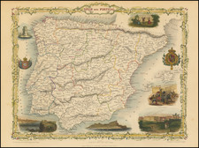
|
||

|

|
|

|
Decorative large plan of Madrid, originally issued by Nicolas De Fer and published in Paris by his son in law, J.F. Benard.
De Fer's map of Madrid is one of the largest obtainable maps of the Spanish Capital published in the first half of the 18th Century. Embellished with two large coats of arms, the map identifies buildings, roads, plazas, churches, parks bridges, and a host of other details on a large scale, including profile views of many of the largest buildings.
The plan if quite rare on the market, this being the first example we have seen on the market in nearly 20 years.
Nicholas de Fer (1646-1720) was the son of a map seller, Antoine de Fer, and grew to be one of the most well-known mapmakers in France in the seventeenth century. He was apprenticed at twelve years old to Louis Spirinx, an engraver. When his father died in 1673, Nicholas helped his mother run the business until 1687, when he became the sole proprietor.
His earliest known work is a map of the Canal of Languedoc in 1669, while some of his earliest engravings are in the revised edition of Methode pour Apprendre Facilement la Geographie (1685). In 1697, he published his first world atlas. Perhaps his most famous map is his wall map of America, published in 1698, with its celebrated beaver scene (engraved by Hendrick van Loon, designed by Nicolas Guerard). After his death in 1720, the business passed to his sons-in-law, Guillaume Danet and Jacques-Francois Benard.
![[Cadiz] Isle Ville et Port De Cadis en Espagne de la Province d'Andalousie a 36.D. de Latitude et 12 Degrez 45 Minutes de Longitude](https://storage.googleapis.com/raremaps/img/small/62354.jpg)
![[ Galicia ] Die Zee Custen van Galissien, van Capo Daviles off tot Ortegal . . .](https://storage.googleapis.com/raremaps/img/small/39921.jpg)
![[Portugal / Morocco / Azores & Canary Islands] Pascaarte Van Barbarische cust mitsgaders van de Canarische en Vlaemsche Eijlanden](https://storage.googleapis.com/raremaps/img/small/75279.jpg)