|
||

|

|
|

|
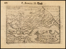
Fine example of the title sheet from Giovanni Antonio Magini's 8 sheet wall map of Italy.
The map covers the Dalmatian Coastine centered on Ragusa (Dubrovnik). Extends south to Cattaro (Koro) and Budva and north to Spit.
Fine large titled and dedication cartouches.
Embellished with a large swordfish like creature.
Magini's wall map was issued as early as 1608, with Sadeler's version of the map printed as early as 1625.
The complete map is very rare. We locate no examples on the market.
Giovanni Antonio Magini was an accomplished Italian cartographer, astronomer, astrologer, and mathematician—in short, a Renaissance man. Born in Padua, he studied philosophy in Bologna. His first publication was Ephemerides coelestium motuum, an astronomical treatise published in 1582. In 1588 he was selected, over Galileo Galilei, to fill the chair of mathematics at the University of Bologna. He died in that city in 1617.
Magini operated under a geocentric understanding of the universe and created his own planetary theory consisting of eleven rotating spheres. He published this theory in Novæ cœlestium orbium theoricæ congruentes cum observationibus N. Copernici (Venice, 1589). In the 1590s he published works on surveying and trigonometry, as well as invented a calculator. In 1596, he published a commentary of Ptolemy’s Geographia, which was published in several editions and languages. He labored for years on an atlas of Italy, which was printed posthumously in 1620. To pay for this project, Magini served as the math tutor to the son of the Duke of Mantua, as well as being the court astrologer to the Duke.
![Plan Des [Ersten?] und Lezten Theil Der Affeire Des Feldmarschal Konigseg in Tyrol](https://storage.googleapis.com/raremaps/img/small/51959.jpg)