


|
||

|

|
|

|
A Superb Folding Map Example of Güssefeld's Version of Tomas Lopez's Atlas of Spain -- From the Library of General Nicolas Charles Oudinot -- and Very Probably Used by Him During the "Hundred Thousand Sons of Saint Louis."
Franz Ludwig Güssefeld's very rare atlas of Spain, here in the rarer 1823 edition, and in a highly desirable folding and boxed format with superb provenance.
26 engraved folding maps on 25 sheets, with the title and index leaf. Housed in two contemporary blue paper boxes.
The 1823 edition was probably issued in response to the French invasion of Spain, generally known as the "Hundred Thousand Sons of Saint Louis", in which the atlas's first owner participated as a corps commander.
"The Hundred Thousand Sons of Saint Louis."
The Hundred Thousand Sons of Saint Louis was the popular name for a French army mobilized in 1823 by the Bourbon King of France, Louis XVIII to help the Spanish Royalists restore King Ferdinand VII of Spain to the absolute power of which he had been deprived during the Liberal Triennium. Despite the name, the actual number of troops was around 60,000. The force comprised some five army corps (the bulk of the French regular army) and was led by the Duke of Angoulême, the son of the future King Charles X of France. French forces entered Spain on April 7, 1823. The Hundred Thousand Sons met their fiercest opposition in Andalusia, finally overcoming it and capturing Cadiz (the Constitutionalists' provisional capital) in November of 1823. Some 45,000 French troops remained in Spain to help secure the monarchy of King Ferdinand VII. Unexpectedly, Ferdinand took ruthless revenge on his opponents, revoked the 1812 constitution and restored absolute monarchy to Spain.
Marshal Oudinot (whose biography can be found below) commanded the First of five French army corps during the invasion.
López's Atlas geografico de Espana
Güssefeld's atlas is based on Tomás López's Atlas geografico de Espana, first published in 1804, and again in 1810. López's Atlas figured prominently in the Peninsular War, as it was the best cartographic treatment of Spain to date.
San-Antonio-Gómez, Velilla, and Manzano-Agugliaro provide an outline of Lopez's cartographic methodology:
To map all of the Spanish provinces, Tomas Lopez divided them into circles of three leagues in diameter (16,718 m), taking a particular town as the centre. He asked the town's priest to draw a map of the territory and to complete a questionnaire that Tomas Lopez sent to him. The priest was to return the two documents after he had completed them. Subsequently, at his desk, Tomas Lopez used the maps and reports as well as other graphic and written sources from various locations to make an outline of each map. Next, he made a mosaic that served as a pattern for drawing the final provincial map.
Rumsey (11510) outlines Lopez's biography:
Don Tomas Lopez (1730-1802) a Spanish cartographer, began his studies at the Imperial College of the Spanish capital. In 1752 he went to continue his training in Paris to learn cartography with the great French mapmaker Jean Baptiste Bourguignon d'Anville (1697-1782). In Paris he was accompanied by, among others, Juan de la Cruz Cano y Olmedilla, Manuel Salvador Carmona and Alonso Cruzado. In 1804, Lopez published his "Atlas Geographic of Spain", the first atlas of Spain that produced by a Spaniard. The children of Lopez repostedthis work in a new edition in 1810 and again in 1830.
Plate List:
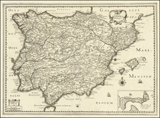
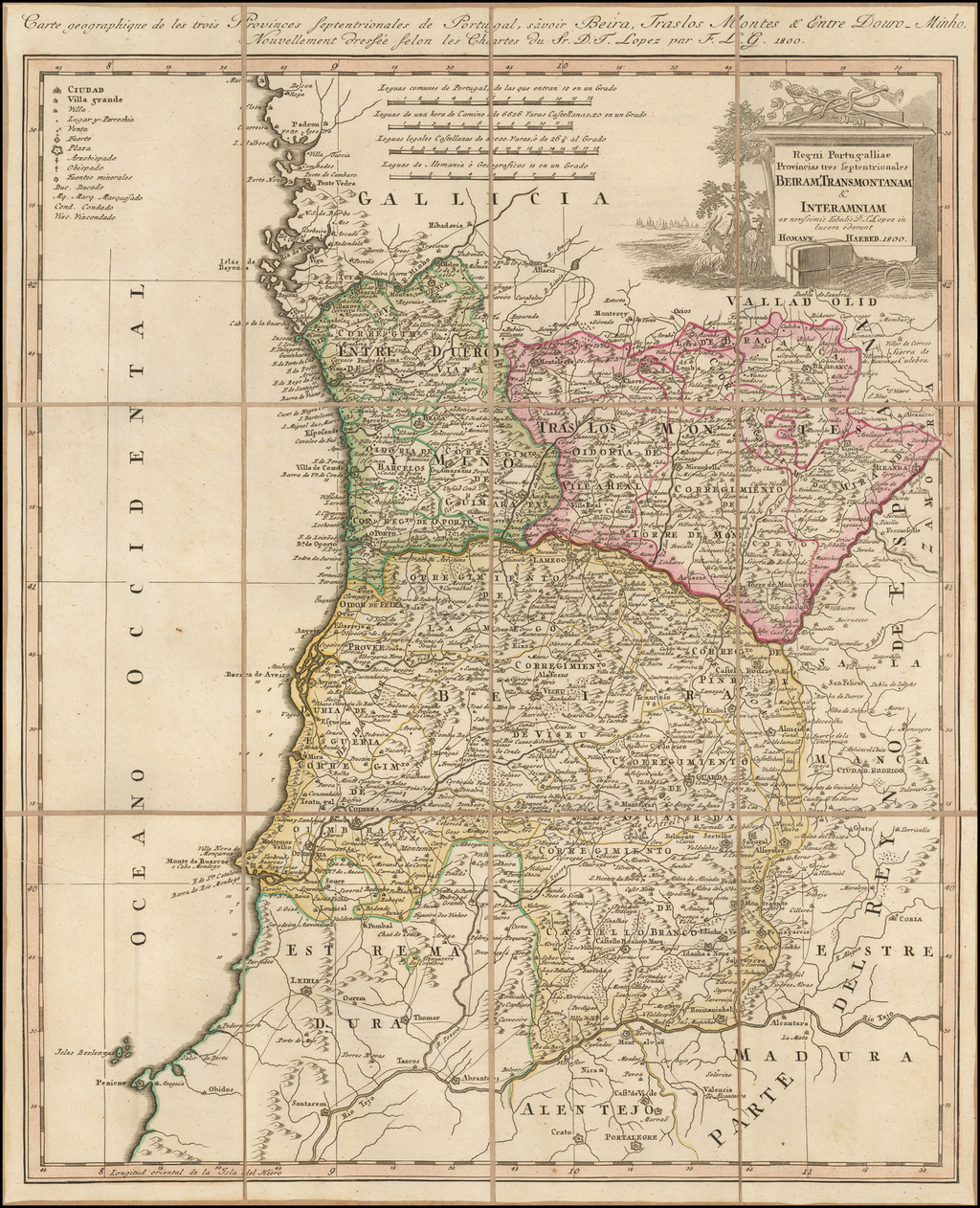
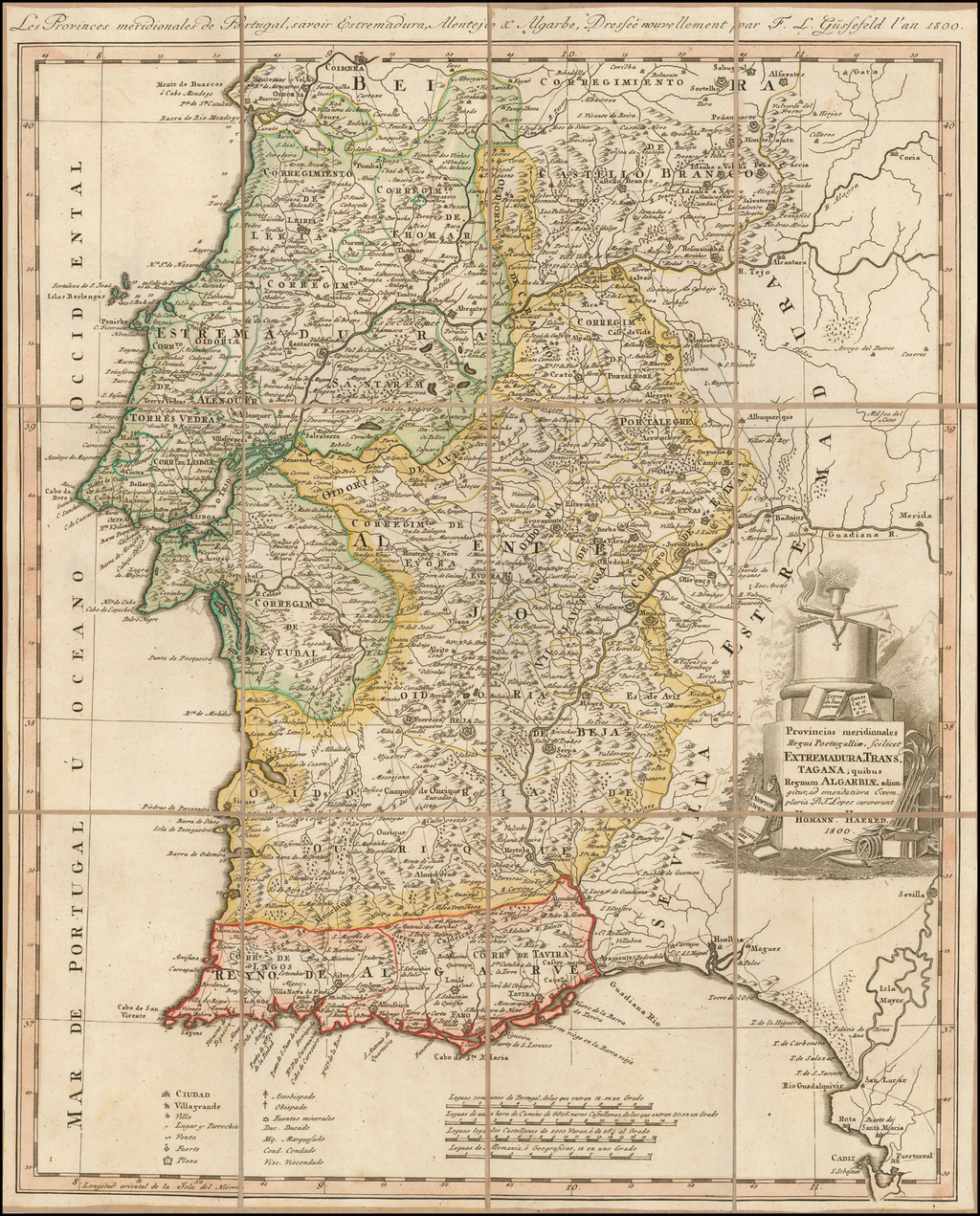
- Spanien und Portugal.
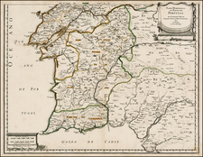
- Portugal%2C+n%C3%B6rdlicher+Theil.
- Portugal%2C+s%C3%BCdlicher+Theil.
- Benedictiner+Spanien.
- Meerenge+von+Gibraltar.
- Neu- Castilien %2C+%C3%B6stlicher+Theil.
- Neu- Castilien %2C westlicher Theil.
- Burgos.
- Soria mit Minorca.
- Segovia+und+Avila
- Leon%2C+Valladolid+etc.+zwey+Bl%C3%A4tter.
- [Ditto.]
- Salamanca.
- Granada%2C+Cordova+%0Aund+Jaen.
- Gallicia .
- Sevilla.
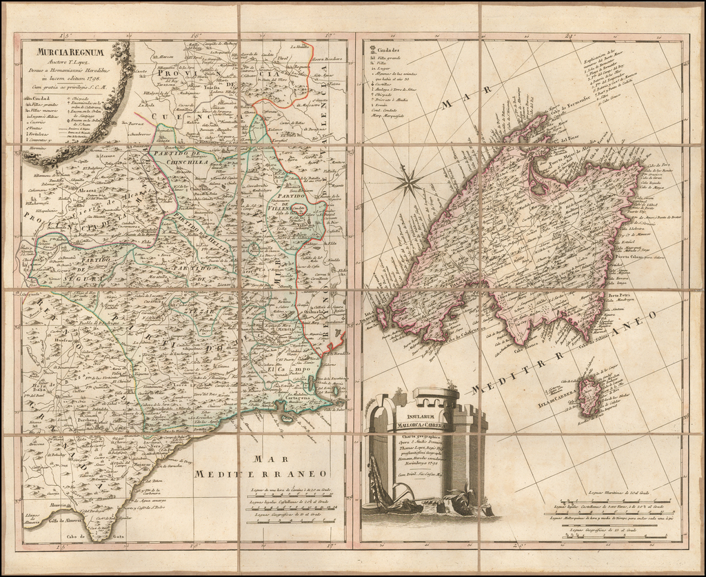
- Murcia mit Mallorca.
- Astrien.
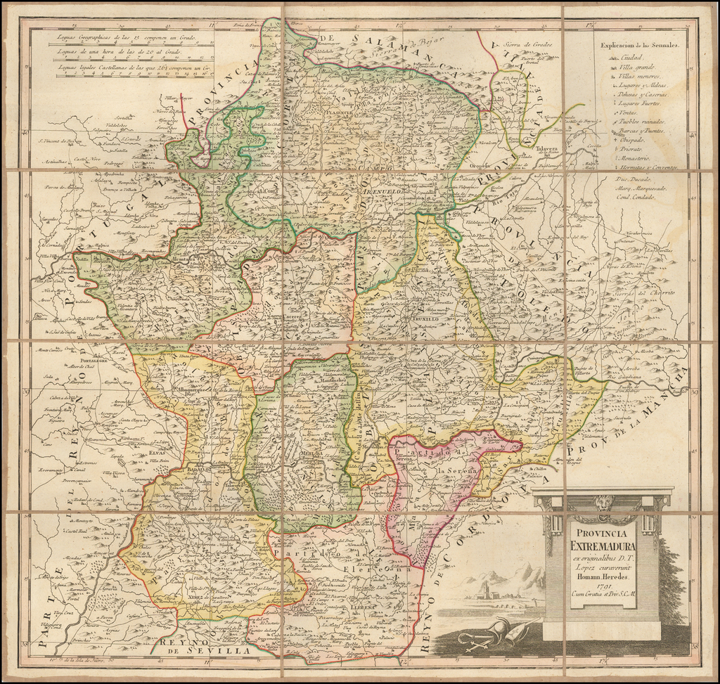
- Estremadura.
- Navarra.
- Guipuscoa%2C+Biscaya%2C+Alava.
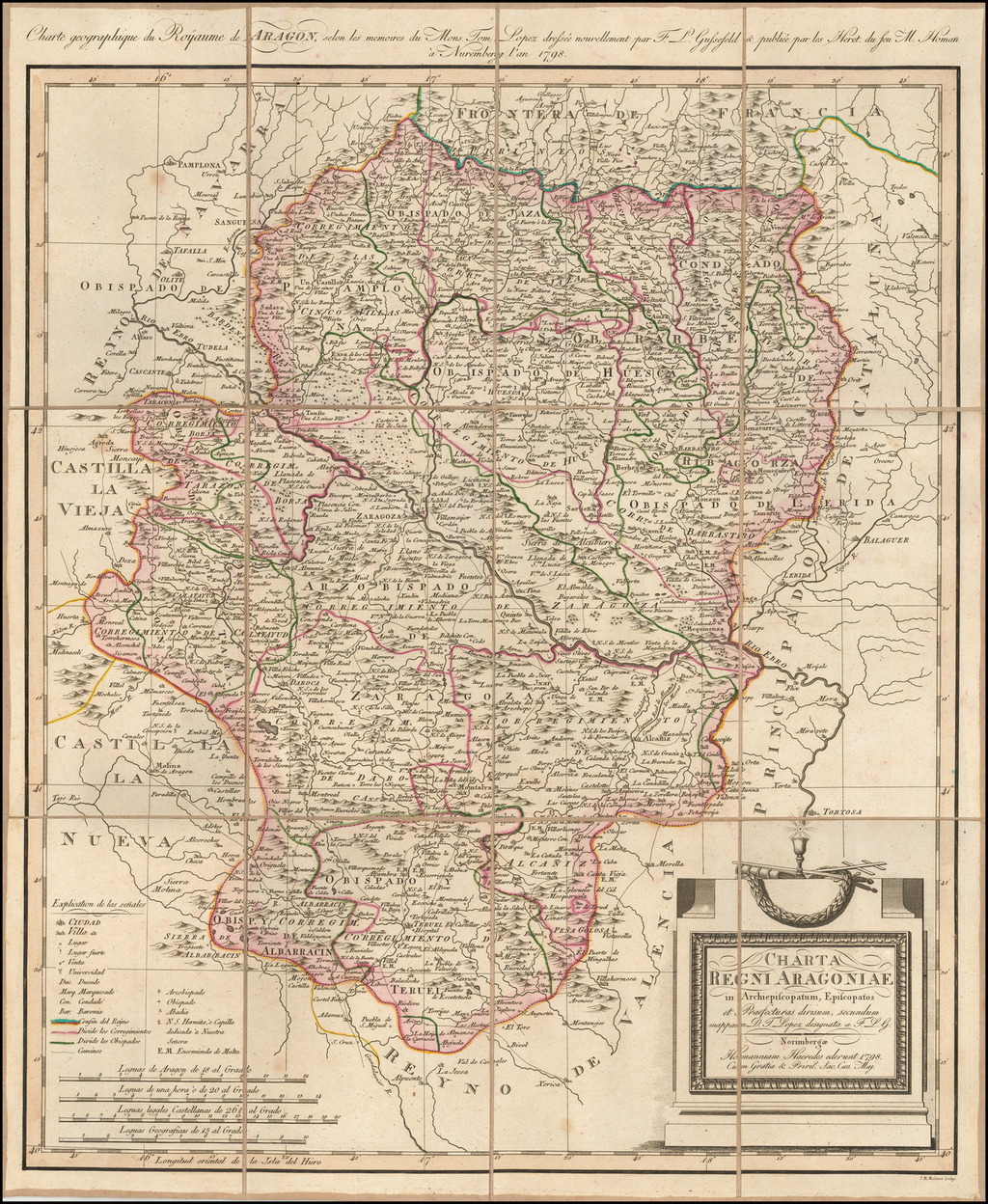
- Aragonien.
- Valencia.
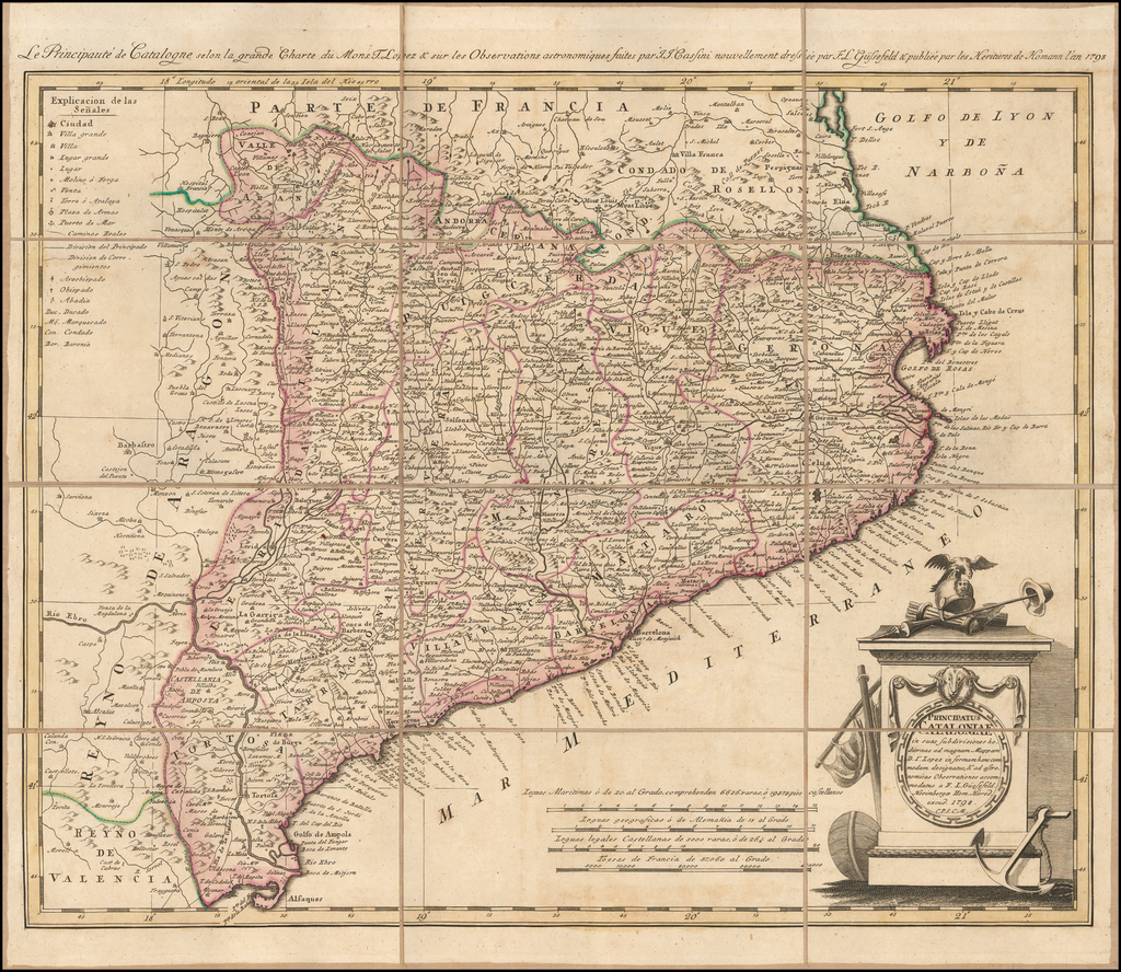
- Catalonien .
- Majorca%2C+Minorca%2C+Yvica+etc.
- Minorca.
General Nicolas Charles Oudinot
A final detail that gives this map particular importance is the identity of its former owner, Nicolas Charles Oudinot, 1st Comte Oudinot, 1st Duc de Reggio (1767 - 1848), and a Marshal of France. A fierce fighter, the man was wounded no less than 34 times during his military career!
The only one of nine siblings to live past childhood, Oudinot joined the army without a noble pedigree, and therefore without a chance of high promotion. That all changed in 1792, with the outbreak of the French Revolution. In that year, Oudinot was elected lieutenant-colonel of the third battalion of the volunteers of the Meuse. After transfer to the regular army and admirable service in Belgium, he was promoted to the rank of general in June 1794 after the Battle of Kaiserslautern.
From Belgium he shifted to the German and Swiss fronts, where he fought as a general of division and chief of staff to Andre Massena. Oudinot stood out at the Battle of Monzambano so much so that Napoleon himself presented him with a sword of honor, now known as the Legion d'Honneur. Napoleon did not forget him after he established his empire; now Emperor Napoleon recognized Oudinot again, this time with a Grand Cross of the Legion of Honor.
During the Napoleonic Wars, Oudinot continued to acquit himself commendably. He was elected a member of the Chamber of Deputies, commanded a company of grenadiers nicknamed for him, and fought in battles from Vienna to Poland. In 1808, he was appointed governor of Erfurt and was made a Count of the French Empire. Finally, in 1809, after the Battle of Wagram, he was named a Marshal of France, France's highest military distinction.
Oudinot continued to serve as an administrator in Holland and on the battlefield in the Russian campaign. After Napoleon's fall, Oudinot joined the Bourbon Restoration and stayed loyal to the King even after Napoleon's return in 1815. For his loyalty and service, he was named a peer of the realm. He served until 1823, when he participated in the French invasion of Spain. Then, he turned again to political and administrative appointments; he died while serving as governor of Les Invalides, at the veterans' hospital in Paris.
Provenance
Purchased at auction in Paris, from Artcuriel, Collections from the Castle of Malicorne Marshal Oudinot's Historical Souvenirs, June 13, 2017 (Lot 156).
Rarity
There is only one recorded example of the 1823 edition, at the Institut Cartogràfic i Geològic de Catalunya. OCLC locates the 1806 edition at the Biblioteca Nacional de Espana, BNF, Strasbourg University Library, Bayerische Staatsbibliothek, and the Philosophical-Theological University of Münster. The last example recorded in Rare Book Hub was an incomplete 1806 set (22 of 26 maps, only) sold by Swann for $350 in 1980.

![[ Lisbon and Cascais ] Lisbona. Olisipo ... vulgo Lisbona Florentissimum Portugalliae Emporiu. [with] Cascale Lusitaniae Opp](https://storage.googleapis.com/raremaps/img/small/96926.jpg)
![[Galicia & Asturias] Le Royaume de Galice Divise en plusieur Territoires et Les Asturies Divisees en Asturie D'Oviedo et de la Santillana Dressez Sure les Memoires de Rodrigo Mendez Silva . . . 1704](https://storage.googleapis.com/raremaps/img/small/33010mp.jpg)