


|
||

|

|
|

|
Fine Map of Berlin Shortly After The Construction of the Berlin Wall
Detailed tourist map of Berlin, published in 1963 by the Presse- und Informationsamt des Landes Berlin.
Of greatest note, there is a single brick wall shown separating East and West Berlin, shortly after the completion of the first wall in 1962, but before the construction of the second wall beginning in June 1963, which established the so-called death strip.
The Press and Information Office of the State of Berlin (PIA) is the Press and Information Section of the Berlin Senate Chancellery. It is directly attributed to the Governing Mayor of Berlin.
The map provides a highly detailed look at East and West Berlin, in 1962, with barbed wire fences surrounding West Berlin on 3 sides and the wall separating the two Berlins on the east side.
An image of the map verso is shown here, with statistical informatoion and a map showing the air corridors and other means of communication with West Berlin: www.raremaps.com/gallery/detail/52278a
Berlin Wall
The Berlin Wall was a guarded concrete barrier that physically and ideologically divided Berlin from 1961 to 1989.
Constructed by the German Democratic Republic starting on August 13, 1961, the Wall completely cut off (by land) West Berlin from surrounding East Germany and from East Berlin until government officials opened it in November 1989. Its demolition officially began on June 13, 1990 and was completed in 1992.
The Wall included guard towers placed along large concrete walls, which circumscribed a wide area (later known as the "death strip") that contained anti-vehicle trenches, "fakir beds" and other defenses. The Eastern Bloc claimed that the Wall was erected to protect its population from fascist elements conspiring to prevent the "will of the people" in building a socialist state in East Germany. In practice, the Wall served to prevent the massive emigration and defection that had marked East Germany and the communist Eastern Bloc during the post-World War II period.
In June 1962, a second, parallel fence was built some 100 meters farther into East German territory. The houses contained between the fences were razed and the inhabitants relocated, thus establishing what later became known as the death strip
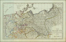
![[ German Postal Routes ] Nouvelle Carte Geographique des Postes D'Allemagne et des Provinces limitrophes . . . / Neue und vollstaendige Postkare durch Ganz Deutschland . . . 1786](https://storage.googleapis.com/raremaps/img/small/99352.jpg)

![Hanc Ger[maniae et P]oloniae de[s ... ]em Serenissim [P]otentissimi Poloniae Regi August offert et inscribit Petrus Schenck](https://storage.googleapis.com/raremaps/img/small/64898.jpg)
![[ Holy Roman Empire ] Germania, Non ea tantum quae Rheno, Vistula, Danubio, mariqz Germanico Veteribus claudebatur; Sed tota illa continens quae hodie communiter Germanica lingua utitur . . .](https://storage.googleapis.com/raremaps/img/small/99236.jpg)
![[Holy Roman Empire] A Newe Mape of Germany Newly Augmented by Iohn Speed Ano Dom: 1626](https://storage.googleapis.com/raremaps/img/small/67323.jpg)