This item has been sold, but you can enter your email address to be notified if another example becomes available.


|
||

|

|
|

|
Stock# 5219
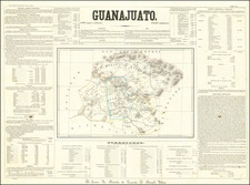
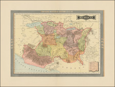
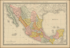
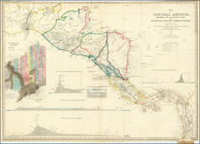
Description
Striking and highly detailed regional map, showing towns, lakes, rivers, townships, railroads, roads, etc. Large inset of the proposed Nicaragua Canal. One of the best large format atlas maps of the region ever produced. Probably the most detailed American Map of the region produced in the 19th Century.