The item illustrated and described below is sold, but we
have another example in stock. To view the example which
is currently being offered for sale, click the
"View Details" button below.
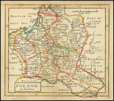
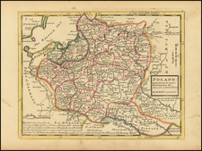
1789 Franz Johann Joseph von Reilly
$ 295.00


|
||

|

|
|

|
Stock# 52186
Description
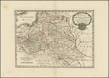
Very scarce regional map of Poland and Lithuania.
Shows rivers, roads, towns, castles, forests, lakes and a host of other details.
South of the Bug River, the cities of Wotiw, Glogau, Breslau, Neysse, Kosel and Glatz are all marked with the Star of David, as is Zikzlaky and Kiev in the south and Konigberg in the north and Wilna (Vilna) in the center of the map. We would presume that this was an indication of a large Jewish population in these cities.
From Von Reilly's exceedingly scarce Grosser Deutscher Atlas. Von Reilley and Schraembl led a revival of map making in Vienna in the late 18th century which included this and several other sought after works.
![[ Poland ] Stati Della Corona Di Polonia Divisa nelle sue Principali Provincie, e Palatinati Da Guglielmo Sansone Geografo del Re Christmo. E di nuovo data in luce da Gio: Giacomo Rossi, in Roma, alla Pace, l'Anno 1678](https://storage.googleapis.com/raremaps/img/small/92116.jpg)