|
||

|

|
|

|
Stock# 51983
Description
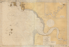
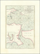
West Java
Attractively color-printed map of Western Java, with a large inset of the Harbor of Batavia and environs, from Stemfoort's Atlas der Nederlandsche bezittingen in Oost-Indië naar de nieuwste bronnen samengesteld en aan de regering opgedragen.
A fine, highly detailed map, with topographical details, place names, and regional borders.
The map is quite rare on the market, this being the first example we have seen.