


|
||

|

|
|

|
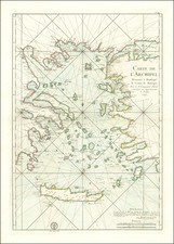
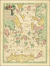
Nice old color example of Mercator's map of Morea, better known as the Peloponnese Peninsula, in Greece.
The Peloponnese Peninsula had played a central role in both history and culture since Homeric times. The large peninsula is connected to mainland Greece only by the narrow Isthmus of Corinth, and jutting deeply southwards, it lay along the crossroads of shipping in the Mediterranean and Aegean seas. Many places still familiar today are labelled on the map, including 'Coryato' (Corinth), 'Napoli' (Nafplio), Patras and 'Cithera' (Cythera), while Athens appears in Attica, to the northeast.
Prominenty featured in the upper part of the map is the Gulf of Lepanto in 1571, the site of an epic naval battle between the forces of the Ottoman Empire and the combined forces of various European states. The outcome was a historical turning point, as it ensured Western maritime supremacy over the Ottomans for decades to come. Even in 1619, almost half a century later, when the present map was printed, the Battle of Lepanto was still top of mind.
Gerard Mercator is one of the most famous cartographers of all time. Mercator was born in Flanders and educated at the Catholic University in Leuven. After his graduation in 1532, Mercator worked with Gemma Frisius, a prominent mathematician, and Gaspar a Myrica, a goldsmith and engraver. Together, these men produced globes and scientific instruments, allowing Mercator to hone his skills.
With his wife, Barbara, Mercator had six children: Arnold, Emerentia, Dorothes, Bartholomeus, Rumold, and Catharina. In 1552, Mercator moved to Duisburg from Leuven, where he lived for the rest of his life. In 1564, he was appointed the official cosmographer to the court of Duke Wilhelm of Cleve.
Mercator’s most important contribution was the creation and popularization of a projection which now bears his name. On Mercator projection maps, all parallels and meridians are drawn at right angles to each other, with the distance between the parallels extending towards the poles. This allowed for accurate latitude and longitude calculation and also allowed navigational routes to be drawn using straight lines, a huge advantage for sailors as this allowed them to plot courses without constant recourse to adjusting compass readings.
Mercator’s other enduring contribution to cartography is the term “atlas”, which was first used to describe his collection of maps gathered in one volume. The Mercator atlas was published in 1595, a year after Mercator’s death, thanks to the work of his sons, particularly Rumold, and his grandsons.
![[ Siege of Corfu ] Plan du Siege de Corfu par Terre et par Mer avec la situation de deux Flottes Venitienne et Ottomanne depuis le jour de L'entree de celles des Ottomans dans le canal le 5me de Iuillet jusqu an 2 6me d'aout 1716, Iour de sa retraite.](https://storage.googleapis.com/raremaps/img/small/84818.jpg)
![Candia [Heraklion] | Corphu [Corfu]](https://storage.googleapis.com/raremaps/img/small/77540.jpg)