|
||

|

|
|

|
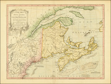
One of the first printed American Railroad maps.
This rare map, dated January 1828, shows the railway route in good detail with topographical information and towns, buildings, rivers, bridges and much more.
The maps shows two proposed routes, both arriving in Providence. The northernmost route begins near the house of Madam Swan on the road between Roxbury to the South Boston Turnpike, and the southern route begins in Boston proper.
Modelski illustrates this map on page 3 noting in the caption that this map is the earliest topographic map in the Library of Congress showing a railroad survey. The map appeared in "Report of the Board of Commissioners, of Internal Improvement in Relation to the Examination of Sundry Routes for a Railway from Boston to Providence, with a Memoir of the Survey," published in Boston in 1828 and printed by Dutton & Wentworth. The 72-page report is by Josiah J. Fiske, Chairman of the Board of Internal Improvement to Levi Lincoln, Governor of the Commonwealth of Massachusetts. Only 1500 copies of the report were printed, very few of which have survived.
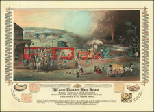
![[ Temperance Allegorical View ] Black Valley Railroad. Tickets Sold at all Liquor Shops. Accidents by Collisions are Entirely Avoided, as no up Trains are Run Over the Road.](https://storage.googleapis.com/raremaps/img/small/101469.jpg)
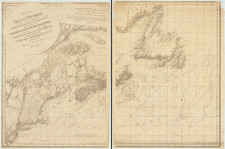
![[ Cape Cod to Acadia ] Pas-Kaart Vande Zee Kusten inde boght van Niew Engeland Tusschen de Staaten Hoek en C.de Sable . . .](https://storage.googleapis.com/raremaps/img/small/94453.jpg)