|
||

|

|
|

|
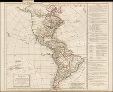
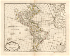
Scarce decorative map of the America and the Pacific, including New Zealand, published in Amsterdam by Jacob Van Meurs for the German edition of Arnold Montanus' America.
Unlike the Dutch edition (map by Van Schaegen) and English edition (Ogilby), which copied the De Wit / Visscher America map, Van Meurs creates a fantasticallly decorative new plate for the German edition, which was later acquired by Pierre Vander Aa and re-issued bearing Vander Aa's name circa 1714.
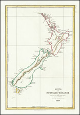
The map shows California as an Island on the first Sanson Projection, showing a single large Great Lake (open at the west), a curious northeasterly coastline north of the Island of California and misprojected South America, with tribal vignettes in Brazil and wild life in North America. The map predates La Salle's information on the interior of North America, but includes excellent detail in Canada and the East Coast of North America, noting the Dutch Possessions, the Iroquois regions, N. Anglia, New Amsterdam, the Cheaspeak, Plymouth, and many Indian Place names.
Meurs's map is based upon Nicholas Visscher's map of 1658 (Burden 332), in that it includes the coastline New Zealand and the early Sanson model for California, and only shows one of the Great Lakes, which is updated from Visscher's edition. Visscher in turn drew his information from Joan Blaeu's wall map of the World, pubished in 1648.
The map is most notable for its elaborate allegorical cartouches.