


|
||

|

|
|

|
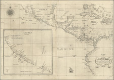
Rare early view of San Diego and the south part of San Diego County, published in conjunction with the Panama-California Exposition.
The map extends from La Jolla and Mt. Soledad in the Southwest to the Tia Juana River and from the Dulzura / Portrero area in the southeast to the Cuyamaca Mountains and Ramona area in the northeast part of San Diego County.
Balboa Park is shown as the Panama-California Exposition park, surrounded by early subdivisions, including Point Loma Heights, Loma Alta No. 2, Roseville, La Playa, Ocean Beach and Spalding Tract in the west and Kensington Park, Normal Heights and East San Diego to the immediate east. A number of smaller communities are shown in the outlying areas, a number of which no longer exist, including:
- Merton
- Foster
- Moreno (near Lakeside)
- Bostonia
- Oneonta
- Coronado Heights (north of Imperial Beach)
- La Presa
- Aloha
Many other early place names.
Mission Valley is mostly farm land, with no signs of development east of Mission Bay.
Pacific Beach is well delineated, but with no sign of the Mission Beach area being developed.
La Jolla and Bird Rock are two separate communities, with no development on Mt. Soledad.
A number of smokestacks are shown along the harbor, illustrating San Diego's robust manufacturing industry.
Western Investment Company / David Charles Collier
David Charles Collier, commonly known as D. C. Collier, was an American real estate developer, civic leader, and philanthropist in San Diego, California, during the early years of the 20th century. He is best known as the organizer and director of San Diego's Panama California Exposition (1915-16). He was also a prime developer of several areas of San Diego as well as La Mesa and Ramona. In his day he was described as "San Diego's foremost citizen."
After his father's death in 1899 he went into law practice with Judge W. P. Andrews and later with Sam F. Smith. Many of his clients paid him in real estate instead of cash. Over time, he turned to real estate development under various names: Ralston Realty Company in 1904, Easton Collier Company in 1905, Western Investment Company in 1908, and D. C. Collier and Company in 1909. He subdivided the land, put in utilities and sold lots in many neighborhoods including Ocean Beach, Point Loma, Pacific Beach, University Heights, Normal Heights, North Park, East San Diego, and Encanto.
Collier built a railroad line to Ocean Beach in 1909, greatly hastening development there, and is considered by some to be the "true father of Ocean Beach". He also bought property in Ramona including five gold mines, and built a country home there on a 240-acre ranch. He also owned a home and poultry farm in La Mesa (then called La Mesa Springs), and built the city's first springhouse to bottle and sell water.
As his business prospered he took a leading role in civic affairs, influencing the city's decision about where to purchase water, persuading Glenn H. Curtiss to bring his fledgling aviation company to North Island in Coronado, and helping the city of San Diego gain possession of its tidelands from the state. He served as president of the San Diego Chamber of Commerce. He served on the staff of California Governor James Gillett from 1907 to 1911. It was Gillett who gave him the courtesy title of "Colonel," which stuck with him for the rest of his life.
Rarity
The view is apparently very rare. We locate no examples on OCLC, although there does appear to be a variant example illustrated on the Panama-California Exposition on line, in the digital archive.
![[ Hungarian Traveler In the California and the West with a Comanche and Wichita to Hungarian vocabulary ] Levelei Éjszakamerikából -- Tizenkét eredeti rajzok után készült kő- és egynéhány fametszettel. Közli Prépost István (Letters from North America)](https://storage.googleapis.com/raremaps/img/small/98502.jpg)

![[San Juan Capistrano to San Onofre] Capistrano Quadrangle](https://storage.googleapis.com/raremaps/img/small/83563.jpg)