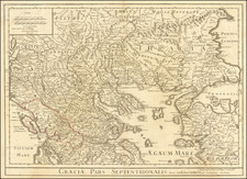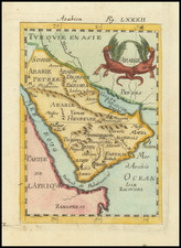


|
||

|

|
|

|
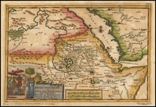
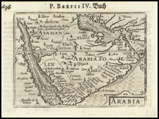
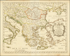
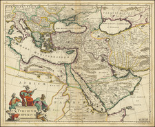
Striking map of the Turkish Empire bounded by the Eastern Mediterranean, Greece, and Italy in the West and Saudi Arabia, the Persian Gulf and Caspian Sea in the east and centered on Turkey and Cyprus.
This fine map depicts the Ottoman Empire on the eve of the Great Turkish War (1683-1699), which marked a turning point in the fortunes of the empire and that of Europe. Up to the 1680s, the European Christian powers of Habsburg, Austria, Russia, Poland-Lithuania and the Republic of Venice, had separately fought the Ottoman Empire in numerous wars over the last century only to arrive at a stalemate. The Turks had largely kept the great gains they had made during the reign of Suleiman the Magnificent (ruled 1520-66), in spite of innumerable attempts by the Christian powers to dislodge them. The line of control generally ran through Croatia, the middle of Hungary and northern Romania, to what is now Moldova, with the Ottoman lands being to the south of the line.
In 1683, an Ottoman army broke out of Hungary to besiege Vienna, the Habsburg capital. This sent a shockwave throughout Europe, and only the intervention of Poland's King Jan Sobieski saved the city. In 1684, the region's main Christian powers formed the Holy League, marking the first time that they all joined forces to fight the Ottomans. This quickly turned the tables, as the Allies inflicted a series of severe defeats on the Turks. The Second Battle of Mohács (1687) restored all of Hungary to the Habsburgs. The decisive showdown of the war was the Battle of Zenta (1697) in Serbia, whereby an Allied force under Prince Eugene of Savoy crushed the main army of the Ottoman Sultan Mustafa II.
The Turks sued for peace and the war was concluded at the Treaty of Karlowitz (1699). By the treaty, Austria won all of Hungary, areas in the Balkans and Transylvania; Poland-Lithuania regained Podolia; Russia acquired the key Black Sea port of Azov and Venice acquired Morea and inner Dalmatia. The war was highly consequential in the long run in that it signaled the beginning of a progressive decline in the size and influence of the Ottoman Empire.
The map is embellished with a decorative cartouche, featuring figures in elaborate Turkish costumes.
Frederik De Wit (1630-1706) was an Amsterdam publisher who became the leading Dutch map producer following the decline of the Blaeu firm in 1672. He was noted for his visually attractive style and grand projects, such as monumental wall maps.
The present example represents the first state (of 2 states) of the map, with only the engraver's name (Johannes Lhuilier) shown at the bottom right. Cartographically, this state pre-dates the addition of 'Tripoli Regnum' , with a different boundary than that which was shown on the second state of the map.
De Wit (1629 ca.-1706) was a mapmaker and mapseller who was born in Gouda but who worked and died in Amsterdam. He moved to the city in 1648, where he opened a printing operation under the name of The Three Crabs; later, he changed the name of his shop to The White Chart. From the 1660s onward, he published atlases with a variety of maps; he is best known for these atlases and his Dutch town maps. After Frederik’s death in 1706, his wife Maria ran the shop for four years before selling it. Their son, Franciscus, was a stockfish merchant and had no interest in the map shop. At the auction to liquidate the de Wit stock, most of the plates went to Pieter Mortier, whose firm eventually became Covens & Mortier, one of the biggest cartography houses of the eighteenth century.