|
||

|

|
|

|
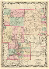
Rare railroad promotional map of part of Dakota Territory, showing the division between North Dakota and South Dakota 7 years prior to the actual division of the Territory.
Rice's map is unrecorded. In addition, this example includes two rubber-stamped elements in red: an explanatory note and a table of distances. There are also very extensive manuscript notations in red ink on the face of the map, indicating the locations of Indian reservations and military posts, characterizations of the nature of the land, and geographical features not originally included on the map.
There are also yellow highlight markings in the Black Hills, presumably to designate the gold regions. These markings are not noted in the list of References at the bottom left, so it is not clear if they are original or added later along with the manuscript notations in red. A red notation in this area indicates "Gold".
This is the first edition of this map, with a copyright date of 1876. Printed Maps of the Mid-West 11-0556 lists an 1878 issue of this map, but not this 1876 edition. These maps are among the first generation of commercially produced maps of this region which was attempting to capitalize on the gold discoveries in the Black Hills.
According to Streeter, the first map to indicate gold regions in the Black Hills had been the 1874 Wood Map of the Black Hills.
History of Dakota Territory
Following the Civil War, hostilities continued with the Sioux until the 1868 Treaty of Fort Laramie. By 1868, creation of new territories reduced Dakota Territory to the present boundaries of the Dakotas. Territorial counties were defined in 1872, including Bottineau County, Cass County and others.
During the existence of the organized territory, the population first increased very slowly and then very rapidly with the "Dakota Boom" from 1870 to 1880. Because the Sioux were considered very hostile and a threat to early settlers, the white population grew slowly. Gradually, the settlers' population grew and the Sioux were not considered as severe a threat. The population increase can largely be attributed to the growth of the Northern Pacific Railroad.
Commerce was originally organized around the fur trade. Furs were carried by steamboat along the rivers to the settlements. Gold was discovered in the Black Hills in 1874, which attracted more settlers, setting off the last Sioux War. The population surge increased the demand for meat, spurring expanded cattle ranching on the territory's vast open ranges. Economic hardship hit the territory in the 1880s due to lower wheat prices and a drought.
The Dakota Territory was divided into the states of North Dakota and South Dakota on November 2, 1889. Admission of new western states was a party's political battleground, with each party looking at how the proposed new states were likely to vote. At the beginning of 1888, the Democrats under president Grover Cleveland proposed that the four territories of Montana, New Mexico, Dakota and Washington should be admitted together. The first two were expected to vote Democratic and the latter two were expected to vote Republican, so this was seen as a compromise acceptable to both parties. However, the Republicans won majorities in Congress and the Senate later that year. To head off the possibility that Congress might only admit Republican territories to statehood, the Democrats agreed to a less favorable deal in which Dakota was divided in two and New Mexico was left out altogether. Cleveland signed it into law on February 22, 1889 and the territories could become states in nine months time after that. However, incoming Republican president Benjamin Harrison had a problem with South Dakota; most of the territory was Sioux reservation land and the state would not be viable unless much of this land became available to settlers.
There had been previous attempts to open up the territory, but these had foundered because the Treaty of Fort Laramie (1868) required that 75% of Sioux adult males on the reservation had to agree to any treaty change. Most recently, a commission headed by Richard Henry Pratt in 1888 had completely failed to get the necessary signatures in the face of opposition from Sioux leaders and even government worker Elaine Goodale, later Superintendent of Indian Education for the Dakotas. The government believed that the Dawes Act (1887), which attempted to move the Indians from hunting to farming, in theory meant that they needed less land (but in reality was an economic disaster for them) and that at least half was available for sale. Congress approved an offer of $1.25 per acre for reservation land (a figure they had previously rejected as outrageously high) and $25,000 to induce the Indians to sign.
A new commission was appointed in April 1889 that included veteran Indian fighter general George Crook. Crook pulled out all the stops to get the Indians to sign, using a number of underhanded tactics. He threatened them that if they did not sign, the land would be taken anyway and they would get nothing. This would not have been seen as an idle threat, the treaty had been ignored in the past when the Black Hills were taken from the Sioux. Crook ignored leaders like Sitting Bull and Red Cloud who opposed the sale and kept them out of the negotiations, preferring instead to deal with moderate leaders like American Horse. American Horse, however, claimed immediately afterwards that he had been tricked into signing. Crook made many personal promises (such as on reservation rations) which he had no authority to make, or ability to keep. He claimed afterwards that he had only agreed to report the concerns back to Washington. Crook lied about how many signatures he already had, giving the impression that the signatures he was currently asking for would make no difference. He said that those who did not sign would not get a share of the money for the land. Crook even allowed white men who had married Sioux to sign, a dubious action given that the blood quantum laws only counted full-blood Indians as members of the tribe. By August 6, 1889, Crook had the requisite number of signatures, half the reservation land was sold, and the remainder divided among six smaller reservations.

![Carte De La Louisiane Et Du Cours Du Mississipi . . . Juin 1718 [1st State!]](https://storage.googleapis.com/raremaps/img/small/59797.jpg)