|
||

|

|
|

|
An Early Northern Pacific Railroad Rarity
One of the earliest large format separately published maps to show the projected route of the Northern Pacific Railroad.
The map is perhaps the earliest realistically obtainable map to show the projected route of the Northern Pacific Railroad on a large scale. The focus of the map is unquestionable promotional, with extensive annotations and illustrations showing users the remarkable attributes of the lands contigous to the route, including:
- The grazing perrennial and unlimited all through this region (Montana)
- Covered with Bunch Grass which cured hay in summer and winter (Eastern Washington)
- Latitude of Bordeaux and Venice (Cheyenne, Wyoming)
- The Continental Wheat Garden
- Unlimited and perrenial grazing (South Saskatchewan)
- Latitude of London (Regina, Saskatchewan)
- Latitude of Paris (Portal, North Dakota)
Rumsey describes the map as:
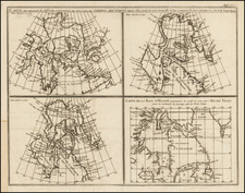
A spectacular map, missed by Wheat. Shows the route of the proposed Northern Pacific Railroad. Covers the entire U.S. and Canada west of the Mississippi, and south to the 38th parallel. One immediately recognizes the use of the Warren/Freyhold "Map of the Territory of the United States..." of 1868, for the lower portion of this map - it is an exact copy. The upper portion appears to be a copy of some official English and/or Canadian survey map.
The map shows Isothermal lines, railroad routes, latitudes of major European Cities, Distances to Asia, Coal fields, and notes about usability of the soil and forests are added.
A profile shows the "Difference Between The Elevations of the Northern Pacific and the Union Pacific Railroads."
This map was compiled in 1871 by Edward H. Knight who used English, Canadian, and United States maps and surveys to identify the region of importance to the Northern Pacific Railroad (NPRR). Knight's map was drawn before the NPRR had been completed. The dotted line is a rough plan for the route which would be adjusted by survey crews in the next couple of years.
In 1871, the NPRR had reached Moorhead, Minnesota across the Red River from Fargo. Some track had been laid from the western end as well. Tracks reached the Missouri River at the small village of Edwinton (soon to become Bismarck) in June 1873.
In September 1873, the railroad's major financial backer, Jay Cooke & Company, shut down in part because of the excessive costs of constructing a railroad into the west. The closing of Cooke & Company led to a national economic panic. The NPRR did not resume construction until 1877. The Missouri River presented a major obstacle for the company. For several years, ferries transported passengers and freight across the river, and in very cold winters when the ice was thick enough, rails were laid on the river's ice surface. A bridge was constructed across the Missouri in 1882.
Finally in September 1883 the tracks from east and west connected and the railroad's president, Henry Villard led hundreds of guests on four special trains to celebrate the completion. On the way west, he and his guests stopped at Bismarck, Dakota Territory, where he attended (for about 45 minutes) the dedication of the new territorial capitol.
OCLC locates only a few examples. Only one dealer (and no auction) records in the past 30 years (High Ridge Books, 1987).