|
||

|

|
|

|
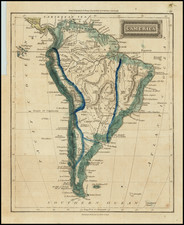
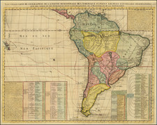
One of the rarest 16th Century Maps of South America
Rare first edition of the Hulsius map of South America, which appeared in his Brevis & admiranda descriptio regni Guianae, auri abundantissimi, in America, Hulsius' edition of Sir Walter Raleigh's travels in America.
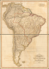
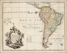
Very rare map of South America, embellished with natives, fauna and flora within the map. Also includes allegorical and mythological figures, sea monsters and sailing ships along the coast line. The map was originally published by Hulsius to illustrate Schmidel´s Vera Historia, one of the volumes of his collection of voyages. This is one of the most accurate maps of South America of the 16th century.
According to Kohl,
the map is based upon a manuscript map in the Dépot de la Marine at Paris. Para, near the mouth of the Amazon, founded soon after 1620, is not indicated, and the course of the Amazon is not improved upon the type fashioned after the reports of Orellana in 1542. Near Lake Titicaca is a legend about the explorations of Nuno de Chaves, in 1557-1560. The names and inscriptions are nearly all Spanish, with an admixture of Portuguese in Brazil. The designations of the oceans and a few other names are French. These features indicate a French draughtsman, working on Spanish and Portuguese models.
This is also one of the earliest obtainable maps to show the Orinoco as an inland river.
The notation to the right of S. Cruz (St. Croix, VI), "Guanahani 1492", indicates the island where Christopher Columbus' ships first landed upon arriving in the Americas, although that island is now believed to be in the Bahamas, in a different part of the Caribbean.
Includes scenes of cannibalism and warfare, Amazons, blemmyae, ships and animals such as armadillo, turtle, flying fish, and a sloth.
There are two editions of the map, which can be distinguished by the date in the title at the top of the map.