|
||

|

|
|

|
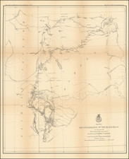
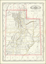
One of the earliest obtainable maps of Utah Territory.
Asher & Adams map of Utah is among the earliest map of Utah Territory in its modern configuration to appear in a commercial atlas.
The focus of the map is the railroad and related detail within the map.
Asher & Adams was a New York publishing firm known for their atlases. Notably, their maps were some of the first to prominently exhibit railroad lines, even if this meant a slight reduction in topographical detail. They specialized especially in state and county maps of the United States.
Asher & Adams was a New York publishing firm known for their atlases. Notably, their maps were some of the first to prominently exhibit railroad lines, even if this meant a slight reduction in topographical detail. They specialized especially in state and county maps of the United States.
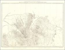
![[Run of 6 Volumes] Report Upon Geographical Surveys West of the 100th Meridian](https://storage.googleapis.com/raremaps/img/small/74064.jpg)