|
||

|

|
|

|
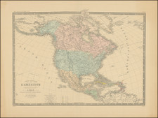
De Vaugondy's North America with extensive manuscript annotations.
Colonial map of North America, immediately prior to the outbreak of the Revolutionary War.
The present example includes extensive manuscript annotions for the Havana, Louisbourg, Dominique and Martinique.
Includes a large unusual Inset of California and the NW Coast of America, and a very unusual projection of the West Coast. The region east of the Appalachians is referred to as Chouanous et Cheraquis. Extensive notes on the Mississippi Valley Indians, French and English forts and other details. The River systems running west from the Mississippi are also of note, along with the Belle Riviere, which seems to extend from Southern Kansas or Northern Oklahoma to the west, quite uniquely and mythically so. The large inset of the west coast is also of great note for its cartographic anomalies, espeically for collectors of the Sea and Rivers of the West and the NW Passage.
This is the fourth of five states, being the first state to include the inset of the NW Coast of America, and typically regarded as the most sought after of all states of the map.
Gilles Robert de Vaugondy (1688-1766) and Didier Robert de Vaugondy (1723-1786) were influential figures in the realm of 18th-century French cartography. Originating from Paris, their contributions to mapmaking were significant during an era of expansive geographical exploration.
Gilles Robert de Vaugondy entered the world of cartography not through family tradition but through personal interest and the budding opportunities of his time. Born in 1688, he worked during a time when Paris was becoming a central hub for cartographic activities. Gilles often incorporated the latest findings from explorers into his maps, making them sought-after for their contemporary relevance. His connections weren't limited to his immediate circle; he frequently interacted with other key mapmakers, staying updated on the latest techniques and findings.
His son, Didier, was born in 1723 and had the advantage of growing up surrounded by maps and globes. While his father was renowned for maps, Didier made a name for himself in the field of globemaking. His globes were some of the most precise and detailed in France, gaining recognition even among the royalty. In addition to his work in cartography and globemaking, Didier had a keen interest in education, especially after the expulsion of the Jesuits from France. He stepped in to produce geographical educational materials, fulfilling a newfound need.
The maps and globes produced by the Vaugondys remain an enduring testament to the peak of French cartography during the Enlightenment. Their works, characterized by precision and the inclusion of contemporary findings, helped to shape our understanding of the world during a transformative period in European history.

![[Educational Map] North America](https://storage.googleapis.com/raremaps/img/small/68773.jpg)