|
||

|

|
|

|
Fine example of Joan Blaeu's plan of Rome, from Blaeu's Theatrum civitatum et admirandorum Italiae, first published in 1663.
The present edition, re-issued by Mortier, includes a grid pattern, added to the original Blaeu plate.
This finely engraved work illustrates Baroque Rome at its very finest, showcasing in pictographic detail, virtually every building, bridge and statue and monument within the city's ancient walls. Highlights include the Colosseum (near the center), the Baths of Diocletian (ruins to the east), and the Vatican, located on the southwestern edge of town.
The general grandeur of the city's newer buildings and boulevards is the result of the urban development plans initialized by Pope Sixtus V (reigned 1585-90). At the time that this plan was issued, the Medieval city (largely built with Roman ruins) had already largely given way to the grand palaces and squares adorned with statues and fountains - the Rome of Francesco Borromini and Gian Lorenzo Bernini.
The insignias of the 14 regions of Rome are shown at the bottom, along with two large ornate cartouches and a title cartouche. The Chigi Family arms of the current Pope Alxander VII (reigned 1655-67) are located in the upper-right.
Blaeu's townplans are much rarer than the works of his contemporaries, for many copies of his townbooks perished in fire that ravaged Blaeu's workshop in 1672.
A striking and crisply engraved example in near fine condition.
Willem Janszoon Blaeu (1571-1638) was a prominent Dutch geographer and publisher. Born the son of a herring merchant, Blaeu chose not fish but mathematics and astronomy for his focus. He studied with the famous Danish astronomer Tycho Brahe, with whom he honed his instrument and globe making skills. Blaeu set up shop in Amsterdam, where he sold instruments and globes, published maps, and edited the works of intellectuals like Descartes and Hugo Grotius. In 1635, he released his atlas, Theatrum Orbis Terrarum, sive, Atlas novus.
Willem died in 1638. He had two sons, Cornelis (1610-1648) and Joan (1596-1673). Joan trained as a lawyer, but joined his father’s business rather than practice. After his father’s death, the brothers took over their father’s shop and Joan took on his work as hydrographer to the Dutch East India Company. Later in life, Joan would modify and greatly expand his father’s Atlas novus, eventually releasing his masterpiece, the Atlas maior, between 1662 and 1672.
Cornelis Mortier (1699-1783) was a Dutch publisher who specialized in geography. Cornelis’ father, Pierre Mortier the Elder (1661-1711), had obtained a privilege in 1690 to distribute the works of French geographers in the Netherlands. After his widow continued the business for several years, Cornelis took over in 1719.
In 1721, Mortier forged a partnership with Johannes Covens, who had recently married Cornelis’ sister. They published under the joint name of Covens & Mortier. Their firm was one of the largest and most successful in Dutch history and continued in business until the late-nineteenth century.
In 1774, upon the death of his father, Johannes Covens II (1722-1794) took over his father’s share. In 1778, the company changed its name to J. Covens & Zoon, or J. Covens & Son. Covens II’s son, Cornelis (1764-1825), later inherited the business and brought Petrus Mortier IV back into the fold. Petrus was the great-grandson of Petrus Mortier I. From 1794, the business was called Mortier, Covens & Zoon, or Mortier, Covens, & Son.
The business specialized in publishing French geographers including Deslisle, Jaillot, and Sanson. They also published atlases, for example a 1725 reissue of Frederik de Wit’s Atlas Major and an atlas, with additions, from the works of Guillaume Delisle. There were also Covens & Mortier pocket atlases and town atlases. The company profited from acquiring plates from other geographers as well. For example, the purchased Pieter van der Aa’s plates in 1730. Finally, they also compiled a few maps in house. At their height, they had the largest collection of geographic prints ever assembled in Amsterdam.
![[Italy] Al Molto R.do & Illustre S. or Abbate Andrea Lippomani. Il Golfo di Venetia . . .](https://storage.googleapis.com/raremaps/img/small/91527.jpg)
![[Tuscany / Florence] Dominio Fiorentino](https://storage.googleapis.com/raremaps/img/small/89663.jpg)
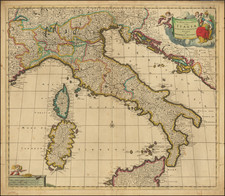
![Tabula Nova Italiae [New Map of Italy]](https://storage.googleapis.com/raremaps/img/small/103202.jpg)