


|
||

|

|
|

|
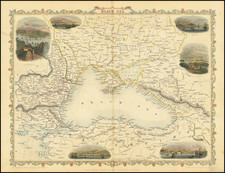
Detailed regional map of Western Ukraine and Eastern Poland, based upon a 4 sheet map of the Ukraine by Guillaume Le Vasseur de Beauplan.
The map was first published by Blaeu circa 1670 and later re-issued by Mortier and by Covens & Mortier.
Willem Janszoon Blaeu, patriarch of the Blaeu cartographic dynasty, died in 1638. He had two sons, Cornelis (1610-1648) and Joan (1596-1673). Joan trained as a lawyer, but joined his father’s business rather than practice. After his father’s death, the brothers took over their father’s shop and Joan took on his work as hydrographer to the Dutch East India Company. Cornelis died in 1648, leaving his brother to carry on the workshop alone. Later in life, Joan would modify and greatly expand his father’s Atlas novus, eventually releasing his own masterpiece, the Atlas maior, between 1662 and 1672. The Blaeu workshop burned in 1672 and Joan died a year later.
Pierre, or Pieter, Mortier (1661-1711) was a Dutch engraver, son of a French refugee. He was born in Leiden. In 1690 he was granted a privilege to publish French maps in Dutch lands. In 1693 he released the first and accompanying volume of the Neptune Francois. The third followed in 1700. His son, Cornelis (1699-1783), would partner with Johannes Covens I, creating one of the most important map publishing companies of the eighteenth century.
![(Ancient Ukraine) Cimmeria quae Postea Scythia Europaea Seu Parua Scythia [Cimmerian, which afterwards became the European Scythia, or the Little Scythia]](https://storage.googleapis.com/raremaps/img/small/82072.jpg)
![[Crimea / Ukraine Battle Map ] Charte der Kriegs Operationen am Donn und Dniepr Ihro Russisch Key Serl: Maiest: Glorieusen Armeen A: 1736 gestorchen bey der keyserl: Acad: der Wissensch: in St. Petersb.](https://storage.googleapis.com/raremaps/img/small/101811.jpg)
![[ Odessa Oblast / Moldova ] Die Landschaft Bessarabien](https://storage.googleapis.com/raremaps/img/small/102847.jpg)
![[ Southern Ukraine / Mykolaiv Oblast / Kherson ] Die Otschakowische Tartarey Oder Westliches Nogaj Auc Jedistan](https://storage.googleapis.com/raremaps/img/small/102019.jpg)