This item has been sold, but you can enter your email address to be notified if another example becomes available.


|
||

|

|
|

|
Stock# 39705
Description
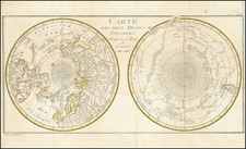
Fine chart showing the discoveries of Sir John Franklin, from his Narrative of the Arctic Land Expedition ... in the Years 1825, 1826 and 1827.
The map extends from Wollaston Land and Dolphin & Union Strait in the east to just beyond Camden Bay in the west, and tracking the route of the MacKenzie River from Great Bear Lake to the Arctic Sea.
Condition Description
2-sheets, joined. Minor foxing and soiling.
![[Unique Extra-Illustrated Example!] Carte Nouvelle Contenant La Partie d'Amerique La Plus Septentrionale, . . . Le Canada ou Nouvelle France, La Nouvelle Ecosse, La Nouvelle Angleterre, Les Nouveau Pais Bas, La Pensylvanie . . . Et Jle. de Terre Neuve . . .](https://storage.googleapis.com/raremaps/img/small/47720.jpg)
![[The Northern and Southern Skies] Hemisphaerii Borealis Coeli et Terrae Sphaerica Scenographia (and) Haemisphaerium Scenographicum Australe Coeli Stellati et Terrae](https://storage.googleapis.com/raremaps/img/small/78919.jpg)